What were the top weather events for 2018?

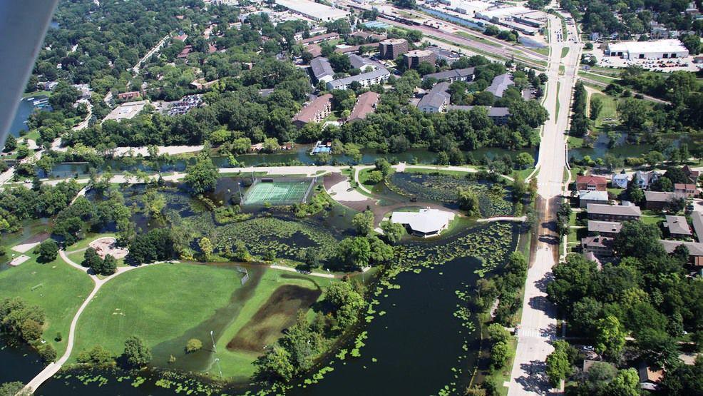
The Yahara River overflowed its banks on the east side of Madison in late August after the rainiest day ever recorded in the city. (Photo credit: Wisconsin Air Coordination Group and Wisconsin Drone Network)

The year began with frigid temperatures across Wisconsin. The average temperatures for the first seven days of January were well below normal across southern Wisconsin with most areas at least 15 degrees below normal.

The end of 2018 saw temperatures several degrees warmer than normal, including a record high temperature of 50 F on Dec. 27, tying a record high for the date, last set in 2003, and previously set in 1936 and 1946.

The year-to-date temperature across the globe was more than 1 degree above the 20th-century average of 57.2 F. That may turn out to be the fourth-highest global mean temperature in the 139-year record,

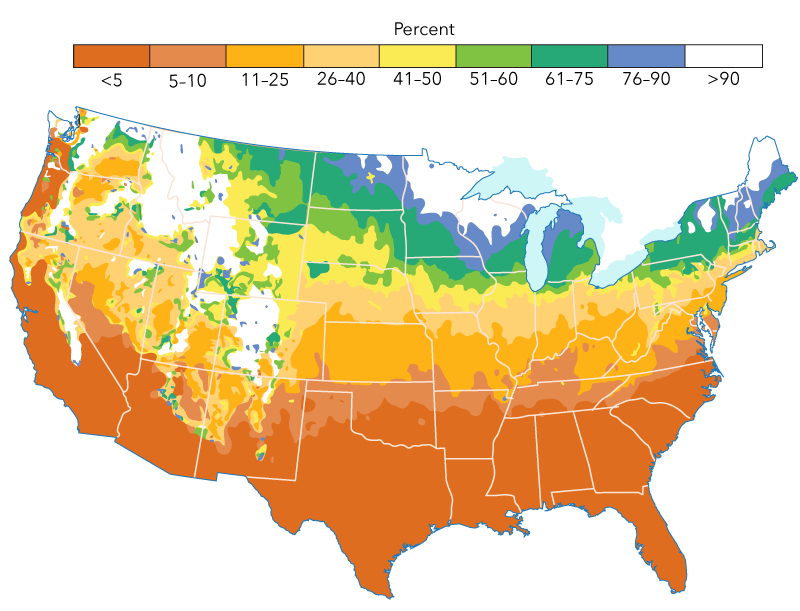
Southern Wisconsin experienced a rainy summer. The August precipitation that fell over the region was about 200 percent of normal. Total precipitation was also above normal for June and July. By the end of summer, we were about 6 inches above normal.

On Aug. 19, 2.74 inches fell on Madison, setting a daily record rain amount, beating the old record of 2.13 inches set in 2007. In particular, August has been exceptionally rainy compared to the prior five Augusts as the only above-normal August in that stretch occurred in 2014 (+1.14 inches).

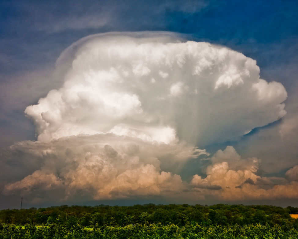
The United States had a below-average number of tornadoes. There were no tornadoes in the U.S. rated above EF3, making 2018 the first year there were no violent tornadoes in the U.S.

There were 17 confirmed tornadoes in Wisconsin on Aug. 28 with the strongest rated as EF-2 on the enhanced Fujita scale. Damage to trees and agriculture was widespread on that day, but there were no reported fatalities or injuries.

Category: Climate, Meteorology, Seasons

Comments Off on What were the top weather events for 2018?

Will there be a White Christmas in Madison this year?

Climatological probability of a “White Christmas” across the contiguous United States.
(Data from NOAA)

In testimony to the infectious appeal of the famous scenes memorialized by Nathaniel Currier and James Ives, prolific lithographers of the middle 19th century, there is an enduring obsession with snow at Christmastime.

A so-called White Christmas is officially observed anytime there is 1 inch of snow on the ground on Christmas morning, whether or not it is snowing at the time.

On average, Madison experiences such a holiday only slightly more than 40 percent of the time. We have had memorably wintry Christmases in the relatively recent past, however. The morning low temperature on December 25, 2000, was a record -21 F with nearly 20 inches of snow on the ground, capping a remarkably snowy month of December that year.

On the other hand, on Christmas Day 1982 the temperature soared to a record high of 56 F with, of course, no snow except at the back door of ice rinks. The next year the minimum temperature on Dec. 25 was a balmy 45 F.

This year it is looking very unlikely that we will record a White Christmas. In fact, thus far in December, our climatologically snowiest month of the year, we have received 1 inch — well behind pace.

Meanwhile, places such as North Carolina and St. Louis have already received their first major storms of the year.

For those of us who are feeling the snow drought more acutely than others, there is some cause for hope. Medium range forecast models are currently suggesting the last week of December may be our first snowy week with a chance of light snow on more than a few of those days.

Steve Ackerman and Jonathan Martin, professors in the UW-Madison Department of Atmospheric and Oceanic Sciences, are guests on WHA radio (970 AM) at 11:45 a.m. the last Monday of each month.


Category: Climate, Meteorology, Seasons

Comments Off on Will there be a White Christmas in Madison this year?

How are clouds named?

This uncommonly clear view of an entire thunderstorm cell, with the top of the growing cumulonimbus tower topping out at 40,000 feet, reveals many interesting features, including “fall streaks” of what may be hail from the underside of the overhanging anvil portion of the cloud. Shortly after this photo was taken on May 22, 2011, near Madison, the storm pelted the Sun Prairie area with large, damaging hail. (Photo credit: Grant Petty, faculty, Department of Atmospheric and Oceanic Sciences, Winner: 2012 Cool Science Image contest)

In 1803, British pharmacist and chemist Luke Howard devised a classification system for clouds. It has proved so successful that meteorologists have used Howard’s system ever since, with minor modifications.

According to his system, clouds are given Latin names corresponding to their appearance — layered or convective— and their altitude. Clouds are also categorized based on whether they are precipitating.

Layered clouds are much wider than they are tall. They generally have flat bases and tops and can extend from horizon to horizon. The Latin word stratus describes the layered cloud category.

Convective clouds are as tall, or taller, than they are wide. These clouds look lumpy and piled up, like a cauliflower. Convective cloud types are indicated by the root word cumulo, which means “heap” in Latin. Convective clouds may become very tall and are rounded on top.

Their altitude and their ability to create precipitation also classify clouds. The root word cirro (meaning “curl”) describes a high cloud that is usually composed of ice crystals which accounts for their wispy appearance. The Latin word alto (“high”) indicates a cloud in the middle of the troposphere that is below the high cirro-type clouds. The prefix or suffix nimbus (“rain”) denotes a cloud that is causing precipitation.

Using the combination of appearance, altitude and ability to make precipitation, a wide range of cloud types can be identified. The 10 basic cloud types are cirrus, cirrostratus, cirrocumulus, altostratus, altocumulus, cumulus, stratus, stratocumulus, nimbostratus and cumulonimbus.

Category: Meteorology, Phenomena

Comments Off on How are clouds named?

How is the atmosphere retained above the Earth?

Earth’s atmosphere and moon from July, 2011.
(Photo credit: ISS Crew / Johnson Space Center)

The atmosphere is actually a fluid. Like water, the pressure at the bottom of a deep column of fluid is larger than the pressure near the top of the column.

Fluids move in response to differences in pressure (the pressure gradient force), always flowing from high toward low pressure. In fact, the wind is driven by pressure differences measured in the horizontal directions. Therefore, the air near the ground (at the bottom of the deep atmosphere) is compelled to move upward toward lower pressure above.

The second fact is that the solid Earth is much more massive than the atmosphere above it which gives rise to the Earth’s gravitational force. Luckily, the force of gravity works in exactly the opposite direction, compelling the air toward the center of the Earth.

To near precision under most conditions, these two forces — the upward-directed pressure gradient force and the downward-directed gravitational force — are balanced, leaving the atmosphere in place surrounding the solid Earth. This important balance is known as the hydrostatic balance.

So, next time you are grateful you are surrounded by an ocean of air, thank the hydrostatic balance.

Category: Meteorology, Phenomena

Comments Off on How is the atmosphere retained above the Earth?

What does the recent cold and snow say about climate change?

It has been quite a week for discussion of global warming.

November has been remarkably cold this year for most of the eastern United States.

In Madison, as just one example, the monthly temperature through Friday has been 6.2 degrees Fahrenheit below normal for the month and, with the prospect of more cold to come, it appears the month will end well below normal.

President Donald Trump, taking note of the near-record cold that was expected for the Thanksgiving holiday, wondered, “Whatever happened to Global Warming?”

Then, on the day after the holiday, the National Climate Assessment, written before the hurricane season and the California wildfires, was released by the Trump Administration answering his question — it continues.

The report synthesizes more than 1,000 peer-reviewed studies regarding the state of the climate and our growing understanding of the issue.

Among the many important statements made in the report, it says that weather extremes associated with the warming climate “have already become more frequent, intense, widespread or of long duration.”

It also reports that over the last decade or so high impact weather has delivered nearly $400 billion dollars in damage to the country, far outpacing any prior records of destruction.

The bottom line is that scientists have reached solid conclusions regarding the threat that climate change poses to our nation, its infrastructure and the quality of life of our fellow citizens.

America has always risen to urgent challenges and met them with courage and eventual success. It is time we turned that indomitable resolve toward this existential problem.

Category: Climate, Seasons

Comments Off on What does the recent cold and snow say about climate change?