When does the last deep cold spell of the winter usually come?

Temperature anomalies outline the extreme cold air outbreak of winter 2021. (Image credit: Climate Reanalyzer, Climate Change Institute, University of Maine)

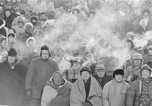
As we all work to recover from our recent cold spell, the natural question is: Are we done with bitter cold for the winter?

If we use an overnight low temperature at or below zero as the definition of a cold spell, then 41 of the 81 winters since 1939-40 have seen a cold spell after Feb. 22 — that’s 50.6% of the time. In fact, in 1982 the last zero-degree or colder night was not until April 2, the latest date in the last 81 years.

None of this bodes well for our chances this year. It should be noted, however, that in the last 20 years, the latest cold spell occurred March 10, in 2003.

Recent research at UW-Madison has documented a systematic warming of the lower troposphere during Northern Hemisphere winter over the past 71 seasons. Elements of that analysis have suggested that the hemisphere begins its warm up much earlier than the spring equinox, which occurs around March 22. In fact, the hemispheric warm up really accelerates in the first few days of March.

Though it is true that this hemispheric signal does not always translate to a similar warm up at any given location, it is comforting to know that the entire hemisphere is trying to shake off winter as early as the next couple of weeks. So whether or not we have just had our last below-zero night of the season, we really do not have that much farther to go.

Category: Climate, Seasons, Severe Weather

Comments Off on When does the last deep cold spell of the winter usually come?

How is the ice cover on the Great Lakes?

Until this recent frigid arctic air outbreak, the Great Lakes were experiencing one of the mildest winters on record

National Oceanic and Atmospheric Administration (NOAA) monitors and reports on the ice coverage of the Great Lakes. NOAA reports total coverage of the Great Lakes is standing at about 32% as of Feb. 12. Historically, much of the major freezing happens in February.

Satellite view of the Great Lakes Region

On Feb. 12, the average concentration of ice on Lake Superior was 23%. Lake Michigan’s ice coverage is currently at 27.9%, and Lake Huron’s coverage is 37.9% at this time. The past week has seen significant ice growth, nowhere more apparent than on Lake Erie, the shallowest of all of the Great Lakes, where the ice coverage is currently at 73.9%. Finally, Lake Ontario ice coverage is 11.6%.

The 2021 ice cover of 32%, the maximum coverage this winter, is significantly lower than the long-term average maximum coverage of 53%. The 2021 amount is higher than the 2017 and 2020 maximums (both about 19.5%) and much lower than the 2018 maximum of 70% and the 2019 maximum of 81%. While there is a large annual variability, across all the Great Lakes the annual maximum ice cover is, on average, 22% lower than it was a half-century ago.

Frolicking on Lake Superior in February. 
Credit: B. Peterson, STAR TRIBUNE

Freezing first occurs along the shoreline, where the water is shallow. Cracks can form in the ice and high winds can push ice floes further from shore. On Feb. 6, 66 people, mostly ice fisherman, had to be rescued from an ice floe on Lake Michigan.

Steve Ackerman and Jonathan Martin, professors in the UW-Madison department of atmospheric and oceanic sciences, are guests on WHA radio (970 AM) at 11:45 a.m. the last Monday of each month.

Category: Climate, Meteorology, Phenomena, Seasons, Uncategorized

Comments Off on How is the ice cover on the Great Lakes?

What is Madison’s longest stretch of frigid temperatures?

Map of current polar vortex
Image credit: NOAA/NWS

After a relatively mild start, this winter has suddenly turned a bit more menacing.

With last Thursday’s 3.5 inches of snow, Madison officially moved above its seasonal average snowfall for the first time all winter. We have received 36 inches, while the average to date is about 33 inches.

This was the last installment in a period of frequent snows that began Jan. 14. Since that day, Madison has had measurable snow on 12 days, out of 21, as evidenced by the substantial snow piles around town. In fact, after Thursday’s snow, we recorded an official snow depth of 13 inches for the first time in 10 years — ending the longest streak (two years longer than its nearest competitor) of snow depth less than 13” in Madison’s history.

And now, in the wake of our most recent snowfall, the first incursion of truly frigid arctic air of the season has been mobilized. Friday’s high temperature of 15 degrees may be the last time we see 15 degrees for well more than a week. We are likely to suffer below-zero overnight low temperatures for nine straight nights.

It appears that we are in for an unusually prolonged cold spell that will struggle to break any single-day records for cold. However, we may make a run at some rather more obscure signatures of winter cold from the past.

The longest string of consecutive days with a daytime high temperature of 10 degrees or less is 10, which occurred in January 1963. The next longest such streak is seven days in January 1994. Tomorrow’s high temperature may well determine whether we make a serious run at the record — if we are 10 degrees or colder tomorrow, we are likely to take the second spot on this list at eight days.

So bundle up, it is going to be cold for a good long time.

Category: Meteorology, Severe Weather, Weather Dangers

Comments Off on What is Madison’s longest stretch of frigid temperatures?

What is the status of Earth’s ice?

The amount of ice covering Earth varies from year to year, but over a few decades, trends emerge.

A recent analysis of satellite observations from the European Space Agency clearly shows the amount of ice on earth is decreasing. Those measurements indicate that the amount of ice, in the form of ice sheets on land, mountain glaciers and sea ice, is decreasing.

The recent analysis of global satellite observations measured ice loss between 1994 and 2017 to be 31 trillion U.S. tons. That is equivalent to a sheet of ice 330-feet thick covering the state of Michigan.

The rate at which Earth is losing ice is also increasing. In the 1990s, Earth lost about 0.9 trillion tons per year, and by 2017 Earth lost about 1.4 tons per year. For perspective, 1.1 trillion tons of ice is about the size of an ice cube measuring 6-by-6-by-6 miles. If placed in northern India, that ice cube would be taller than Mount Everest.

In perspective, one trillion tonnes of ice can be thought of as a cube of ice measuring 10x10x10 km, which would be taller than Mount Everest. Credit: ESA

During the survey period, there was a loss of 8.4 trillion tons of Arctic sea ice and a loss of 7.2 trillion tons from Antarctic ice sheets.

On land, losses include 6.7 trillion tons from mountain glaciers, 4.2 trillion tons from the Greenland ice sheet, and 2.6 trillion tons from the Antarctic ice sheet. The melting of ice on land contributes to a rise in the global mean sea-level. Many mountain glaciers are also a critical freshwater resource for local communities.

The global ice loss is attributed to a global warming of the atmosphere and oceans, which have warmed by 0.47 Fahrenheit and 0.22 F per decade since 1980, respectively.

Category: Climate, Meteorology

Comments Off on What is the status of Earth’s ice?

What is the “Ice Bowl”?

Fans at Lambeau Field watch the Green Bay Packers play the Dallas Cowboys in the NFL championship game Dec. 31, 1967, dubbed the “Ice Bowl.” The coldest game in NFL history saw temperatures of minus 12 to minus 14, with wind chills estimated to be 33 to 37 below zero.  (Photo credit: Associated Press archives)

The “Ice Bowl” refers to the National Football League’s championship game between the Green Bay Packers and the Dallas Cowboys that occurred on Dec. 31, 1967, at Lambeau Field in Green Bay.

The game was for the NFL title. The Packers entered the contest as the two-time defending NFL champions trying to become the first team in the league history to win three consecutive championships.

It was a great matchup between two strong football teams. The official game-time temperature was 13 degrees below zero. It was the first day of a cold stretch that lasted nine days. On seven of those nine days the temperature did not exceed zero.

The weather the day before had a high of 20 degrees. Just before midnight, an Arctic front ushered in bitter cold air.

During the game, temperatures ranged from minus 12 to minus 14, with wind chills estimated to be 33 to 37 below zero. It was, and remains, the coldest game in NFL history.

Despite the frigid temperature, more than 50,000 fans filled the stadium.

Prior to the start of the game, the football field froze. The field was covered with a tarp, but during the night a layer of condensation had built up between the field and the covering. When the tarp was removed, the field was exposed to the cold air and froze.

The Cowboys won the toss, and a reporter in the press box quipped, “Dallas won the toss and elected to go home.” The Packers won the game 21-17, driving 67 yards for the win, leaving 30 seconds remaining on the game clock. After the game, several players were treated for frostbite.

Now, over 40 years later, fans still have fond and frozen memories of that New Year’s Eve game.

Category: Seasons, Severe Weather, Weather Dangers

Comments Off on What is the “Ice Bowl”?