
After a relatively mild start, this winter has suddenly turned a bit more menacing.
With last Thursday’s 3.5 inches of snow, Madison officially moved above its seasonal average snowfall for the first time all winter. We have received 36 inches, while the average to date is about 33 inches.
This was the last installment in a period of frequent snows that began Jan. 14. Since that day, Madison has had measurable snow on 12 days, out of 21, as evidenced by the substantial snow piles around town. In fact, after Thursday’s snow, we recorded an official snow depth of 13 inches for the first time in 10 years — ending the longest streak (two years longer than its nearest competitor) of snow depth less than 13” in Madison’s history.
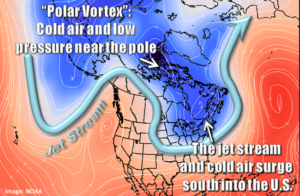
And now, in the wake of our most recent snowfall, the first incursion of truly frigid arctic air of the season has been mobilized. Friday’s high temperature of 15 degrees may be the last time we see 15 degrees for well more than a week. We are likely to suffer below-zero overnight low temperatures for nine straight nights.
It appears that we are in for an unusually prolonged cold spell that will struggle to break any single-day records for cold. However, we may make a run at some rather more obscure signatures of winter cold from the past.
The longest string of consecutive days with a daytime high temperature of 10 degrees or less is 10, which occurred in January 1963. The next longest such streak is seven days in January 1994. Tomorrow’s high temperature may well determine whether we make a serious run at the record — if we are 10 degrees or colder tomorrow, we are likely to take the second spot on this list at eight days.
So bundle up, it is going to be cold for a good long time.