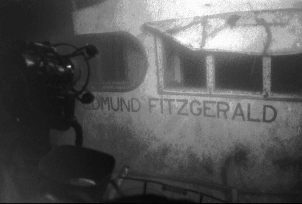
A November gale is associated with the sinking of the Edmund Fitzgerald, a mammoth ore freighter, and the loss of its 29 crew members in 1975. The event was memorialized by Gordon Lightfoot’s ballad “The Wreck of the Edmund Fitzgerald.” (Photo credit: Associated Press)
A gale is a sustained wind between 39 mph and 54 mph.
Gales are usually caused by large differences in the air pressure between a low pressure system and a strong, high pressure system.
Gale winds are common in November on the Great Lakes; however, we have not experienced such gale winds this year. Indeed we have had a very mild November.
In the first half of November, the Midwest has experienced temperatures well above normal as record and near-record temperatures were common. We have certainly not experienced the mid-latitude storm systems that generate gale winds common this time of year.
Last week included anniversaries of some strong November gales in the Great Lakes region. These include the famous Armistice Day Blizzard (Nov. 11, 1940), the Edmund Fitzgerald storm (Nov. 9-10, 1975) and the Nov. 10-11, 1998, storm.
The Armistice Day Blizzard dropped 16.7 inches of snow in Minneapolis/St. Paul. The cyclone intensified rapidly and was accompanied by an intense surface cold front that quickly dropped temperatures as much as 50 degrees in parts of Midwest. This rapid drop in temperature caught many people by surprise, and more than 150 people perished as the storm moved across the Great Lakes region.
The Edmund Fitzgerald storm achieved grisly fame through its association with the sinking of the mammoth ore freighter and the loss of its 29 crew members. That storm also was accompanied by extremely strong winds and rapid intensification over the mid-continent. That event was memorialized by Gordon Lightfoot’s ballad “The Wreck of the Edmund Fitzgerald.”
The Nov. 10-11, 1998, storm underwent a six-hour period in which its minimum sea-level pressure dropped 15 millibars.