What forces a mid-latitude cyclone to develop?

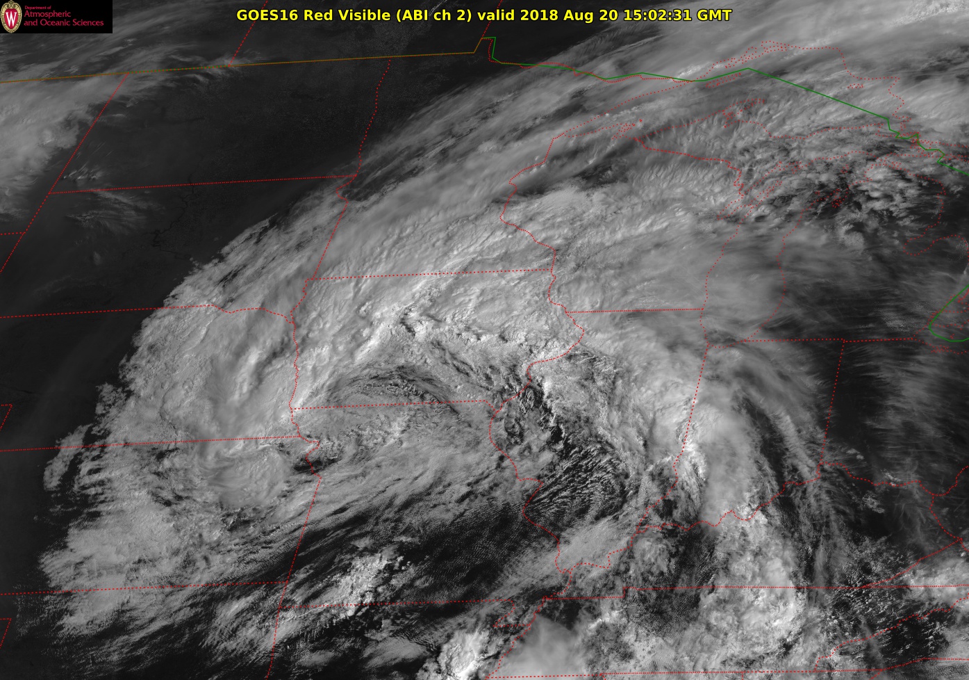
Mid-level cyclone from August 18 via GOES-16.

Our rainy Friday was arguably the first storm, or cyclone, of the autumn/winter season. Though it will surely be followed by more powerful examples, you may well have wondered how do such storms come to be?

That has been the central motivating question in meteorological science for most of the past 100 years. During that time, meteorologists have learned a great deal about how these mid-latitude cyclones are formed.

In most instances, two or more days before the storm is noticed at the surface of the Earth, processes are at work in the upper troposphere. Specifically, at the height of the jet stream (about 6 miles above the surface), weak downward vertical motions begin to drag the tropopause downward into the middle troposphere. This process eventually results in the creation of a mid-level vortex, a region of counterclockwise-rotating winds, about 3 miles above the ground.

Once generated, this vortex is then moved around by the atmospheric winds in its vicinity. At the forward side of this moving vortex, the air is forced to rise. Such upward vertical motion evacuates air from the lower troposphere, lowering the pressure at the surface.

Simultaneously, the upward vertical motion produces clouds and precipitation. So long as the mid-level vortex continues to intensify and move, so too does the surface cyclone. In many cases, the mid-level vortex eventually becomes quasi-stationary and positioned directly above the surface cyclone. This usually marks the end of the intensification for the storm though it can still deliver high-impact weather at this stage.


Category: Meteorology, Seasons

Comments Off on What forces a mid-latitude cyclone to develop?

When is tornado season?

A tornado that touched down Thursday in Deerfield, though relatively weak, tore a roof off International Machinery Exchange, 214 N. Main St. (Photo credit: John Hart, State Journal)

Tornadoes form in regions of the atmosphere that have abundant warm and moist air near the surface with drier air above, a change in wind speed and direction with height, and weather systems such as fronts that force air upward.

The United States provides these three ingredients in abundance, so it is not surprising that the majority of the world’s reported tornadoes occur in the U.S.

Within the United States, tornadoes can occur in nearly every state and in every month of the year. Wisconsin has experienced tornadoes in every month except February.

Tornado season is based on when the ingredients for severe weather come together in a particular place. Because a change in wind with height is closely related to the presence of a jet stream, tornado season moves north and south during the year with a jet stream.

Tornado season peaks in March and April in the Southeast but not until July in the upper Midwest and Northeast. The deep South has a secondary peak in tornado occurrence in November.

Tornadoes can also happen at any time of day or night. However, the most likely times for tornadoes are late afternoon or early evening. More than half of all U.S. tornadoes occur during the hours of 3 p.m. to 7 p.m. local time.

In Wisconsin, June is typically the month when the most tornadoes occur, followed by July. Wisconsin averages 24 tornadoes per year.

So far this year, Wisconsin has experienced only eight tornadoes. The most recent was Thursday in Deerfield. The National Weather Service determined that tornado had 80-mph winds. The storms were relatively weak, in comparison to other tornadoes, but they still caused damage and posed a danger.

Category: Meteorology, Severe Weather

Comments Off on When is tornado season?

Why did the end of July have nice weather?

A bicyclist enjoys relatively cool weather while viewing the backdrop of the La Crosse River Marsh and the bluffs beyond while riding along Lang Drive on July 26. The cooler temperatures across Wisconsin and much of the Midwest in the last week of July resulted from a Canadian high-pressure system that settled over the central U.S. (Photo credit: Peter Thomson, La Crosse Tribune)

During the last week of July — the 25th through 31st — the temperatures across Wisconsin were 1 to 4 degrees below normal. In fact, much of the Midwest was cooler than normal.

The cooler temperatures resulted from a Canadian high-pressure system that settled over the central U.S. during that final week of July.

The Canadian high-pressure is a semi-permanent atmospheric high-pressure system that is associated with generally low temperatures over northern Canada. The Canadian Rockies keep the relatively warm air over the Pacific Ocean from warming Central Canada and the air masses that form there.

In winter the Canadian high consists of cold dense air, and extends only about 2 miles above the surface. When the system moves southeastward in winter, it can bring frigid air to the Midwest. In summer, it provides refreshing cool dry air to our region.

High-pressure systems have sinking air above that inhibits rain clouds from developing. Large areas of southern Wisconsin had less than half the normal amount of rainfall for this time of year. The sinking motions also lower the humidity. High pressures are accompanied by light winds.

The Canadian high-pressure system is generally associated with nice weather in summer. Other high pressure systems, particularly those that form over the Gulf of Mexico and move northward, can be accompanied by high humidity and pose a threat if the heat index is high.

Category: Climate, Seasons

Comments Off on Why did the end of July have nice weather?

How much summer is left?

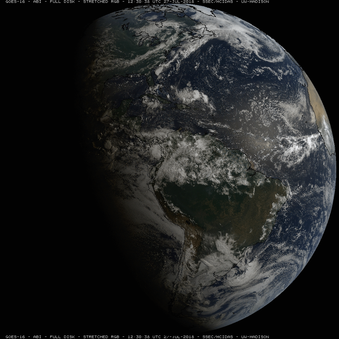
GOES-16 image from 27 July 2018 that shows the terminator and the tilt of the Earth (1 month after the summer solstice).

The welcome respite we just enjoyed from the prolonged heat and humidity of late June and July may have inspired fond thoughts of autumn to many in southern Wisconsin.

Of course, there is still a lot of summer left, though we have just passed the climatologically warmest day of the year in Madison – July 14/15. This closely coincides with the date on which air with a temperature of 23 degrees at about 1 km above the surface shrinks to its annual minimum extent.

In some years, such cold air completely disappears over the entire Northern Hemisphere. In the past five years, for instance, the cold air has completely disappeared for a short period of time in 2013 (July 16), 2015 (July 17-19) and 2016 (July 23) while tiny puddles of such cold air hung on during both 2014 and 2017.

It appears that this year (thus far) the 23-degree air will hold on as it did last year, barely, with its smallest areal extent having occurred unusually early (June 30).

In recent research concerning global warming, we have tracked the areal extent of such air for the last 70 winters (December, January, February), finding that the wintertime coldpool has systematically shrunk since at least 1948. By late January, the coldest point in the Northern Hemisphere winter, its areal extent grows to about 25 million square miles.

So, as you rejoice at our recent relief from the summer’s heat and humidity, be aware that the enormous reservoir of cold air that will occupy the Northern Hemisphere this winter is just beginning to grow and nothing can stop it from spreading.

Category: Climate, Meteorology, Seasons

Comments Off on How much summer is left?

How fast do raindrops fall?

The typical speed of a falling raindrop depends on the size of the drop. A large raindrop, about the size of a house fly, has terminal fall speeds of about 20 mph. (Photo Credit: John Hart, State Journal Archives)

Gravity pulls everything downward. As an object falls, it experiences a frictional drag that counters the downward force of gravity.

When the gravity and frictional drag are balanced, we have an equilibrium fall speed that is known as the terminal velocity of the object. The terminal velocity depends on the size, shape and mass of the raindrop and the density of the air. Thus, it is worth talking a bit about the shape and size of raindrops.

While cartoonists typically draw raindrops in a teardrop or pear shape, raindrops are not shaped in those forms. They are drawn as teardrops to give the image of falling through the atmosphere, which they do.

As the raindrops fall they are flattened and shaped like a hamburger bun by the drag forces of the air they are falling through. Raindrops are at least 0.5 millimeters (or 0.02 inches) in diameter.

You will not find a raindrop any bigger than about one-quarter of an inch in diameter; larger than that, the drop will break apart into smaller drops because of air resistance. Precipitation drops smaller than 0.02 inches in diameter are collectively called drizzle, which is often associated with stratus clouds.

The terminal velocity of cloud droplets, which are typically about 10 microns in radius or 0.0004 inches, is about 1 centimeter per second, or about 0.02 miles per hour. Tiny cloud droplets can stay in the atmosphere because there is upward moving air that overcomes the force of gravity and keeps them suspended in the cloud. Only a very gentle upward movement of air is required to keep them afloat.

Raindrops are larger. A large raindrop, about one-quarter of an inch across or about the size of a house fly, has terminal fall speeds of about 10 meters per second or about 20 mph. That kind of speed can cause compaction and erosion of the soil by the force of impact.

Raindrops are of different sizes, and the smaller raindrops are traveling about 2 mph.

Category: Meteorology

Comments Off on How fast do raindrops fall?