Can we see satellites at night?

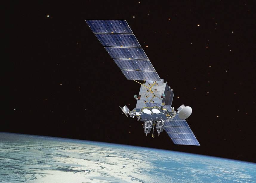
Satellites are visible in the night sky when sunlight reflects off of their solar panels.

Yes, you can see satellites in particular orbits as they pass overhead at night.

Viewing is best away from city lights and in cloud-free skies. The satellite will look like a star steadily moving across the sky for a few minutes. If the lights are blinking, you probably are seeing a plane, not a satellite.

Satellites do not have their own lights that make them visible. What you will see is sunlight being reflected off the satellite, often off the large solar arrays that provide power to the satellites.

These satellites are very high above Earth, about 200 to 300 miles, so while you are in the darkness of night, the sun can still shine on the satellite. Eventually the satellite will fly into the Earth’s shadow and then it will suddenly disappear from view.

The International Space Station (ISS) can be very bright. It orbits Earth at an altitude of about 215 miles traveling at a speed of 17,200 mph. It is a large object with large, highly reflective solar panels making it the brightest of human objects orbiting Earth. It can be as bright as Venus.

You can find out when the ISS is flying over you by visiting this web site, go.madison.com/peqjy, and entering your state and city, or selecting one of the near-by cities from a list.

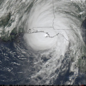
Weather satellites that track clouds and whose images are shown in animations on many websites are orbiting 22,000 miles above us and appear fixed over the equator. You will not be able to see those moving across the sky.

Category: Meteorology

Comments Off on Can we see satellites at night?

Is the number of tornadoes increasing?

Tornadoes are sometimes not seen and thus sometimes not counted. Particularly early in the record keeping.

But scientists interested in this question have studied the change in the key ingredients that form tornadoes, such as wind shear, atmospheric stability and humidity. The more often those ingredients are present, the more likely tornadoes are to form.

So, a recent study counted the number of tornado reports between 1979 and 2016 and also tracked the conditions favorable for tornado formation. They found that increases in the ingredients were reflected in a larger number of tornadoes.

The study found that since 1979, some places have seen increases in tornadoes and other regions showed a decreasing trend. Tornadoes are decreasing in Oklahoma, Texas and Kansas but are increasing in states along the Mississippi River and farther east, including Wisconsin.

Spatial trends in U.S. tornado frequency.
Source: Northern Illinois University

The Great Plains have seen a slight decrease, with the biggest change in central and eastern Texas; however, Texas still has the most tornadoes of any state. The west coast of Florida is the only place east of the Mississippi that didn’t show an increase.

While tornado alley — Oklahoma, Colorado and central and eastern Texas — has the most tornadoes, the states with the deadliest tornadoes are Alabama, Missouri, Tennessee and Arkansas.

Scientists aren’t sure of why the eastward shift has been observed. It could be dry conditions in the plains moving farther eastward.

Why does this matter? The shift eastward means that more people and homes are exposed to a tornado threat.

Steve Ackerman and Jonathan Martin, professors in the UW-Madison Department of Atmospheric and Oceanic Sciences, are guests on WHA radio (970 AM) at 11:45 a.m. the last Monday of each month.
Category: Meteorology, Severe Weather

Comments Off on Is the number of tornadoes increasing?

Is climate change caused by human activity?

In a recent television interview, President Trump made the claim that climate scientists who conclude that climate change is a result of human influence on the atmosphere have a “very big political agenda.”

The president went on to state, in reference to the rapid melting of ice in Greenland, that “you don’t know whether or not that would have happened with or without man. You don’t know.”

click to enlarge

The American Meteorological Society (AMS), the nation’s leading scientific society in the field, politely but unequivocally pushed back on his assertion.

Drawing upon its official position on climate change, issued in 2012, AMS Executive Director Keith Seitter reiterated the society’s consensus view that “the dominant cause of the rapid change in climate of the past half-century is human-induced increases in the amount of atmospheric greenhouse gases.”

Seitter went on to cite multiple lines of evidence to support this conclusion and noted “each of these lines of evidence has undergone rigorous testing and has overcome all credible challenges. They reinforce one another and there are no contradictory lines of evidence that withstand scientific scrutiny.”

He went on to express the society’s desire to contribute to our nation’s response to this looming threat, the urgency of which was heightened by a United Nations report issued Oct. 8th.

“The American Meteorological Society stands ready to provide assistance in connecting executive branch staff with that knowledge and expertise to ensure that you and your staff are working with credible and scientifically validated information as you navigate the many difficult policy areas impacted by the Earth’s changing climate,” Seitter told the White House.

Steve Ackerman and Jonathan Martin, professors in the UW-Madison Department of Atmospheric and Oceanic Sciences, are guests on WHA radio (970 AM) at 11:45 a.m. the last Monday of each month.
Category: Climate

Comments Off on Is climate change caused by human activity?

How accurate was the forecast for Hurricane Michael?

GOES East (GOES-16) satellite image
of Hurricane Michael. click to animate

Five days in advance of Hurricane Michael’s landfall, the National Hurricane Center forecast showed the storm making landfall near Mexico Beach, Florida, with 80 mph winds, just above Category 1 hurricane force.

As we all know by now, the storm lashed the coast with winds in the 155-mph range, or strong Category 4 intensity.

Thus, as is often the case, the forecast of the storm’s path was excellent while the forecast of its intensity was not.

In addition to wind speeds, the intensity of hurricanes is also commonly measured by how low the barometric pressure gets at their centers. Michael recorded the fourth-lowest sea-level pressure of all storms that made landfall in U.S. history.

Why was the eventual intensity of Michael so poorly predicted? A component of the answer is that we lack the density of data required to take full advantage of the computer-modeling technology that underlies short-term forecasting.

The models themselves are forced to make numerical approximations to a number of influential physical processes, such as ocean temperatures and heat content, changes in wind direction with altitude, and interactions with land that control intensification of hurricanes.

Specifically for Michael, early forecasts did predict intensification but not at the rate that was actually observed. Early in its life cycle, Michael was in an unfavorable environment for intensification due to wind shear (change in the wind direction with altitude).

Later the storm moved over some very warm water in the Gulf of Mexico and into an atmosphere with less wind shear. As a result, explosive intensification ensued.

Despite the current difficulties, hurricane forecasts are getting better and improvements will continue but intensification will remain difficult to foresee.

The most important lesson from this storm, if you are in a forecast area in which a hurricane is predicted, and are asked to evacuate — you should do so.

Steve Ackerman and Jonathan Martin, professors in the UW-Madison Department of Atmospheric and Oceanic Sciences, are guests on WHA radio (970 AM) at 11:45 a.m. the last Monday of each month.
Category: Severe Weather, Tropical, Weather Dangers

Comments Off on How accurate was the forecast for Hurricane Michael?

Is the Earth’s spin axis drifting?

The Earth, represented here by a globe on display at the Wisconsin Dairy Expo, wobbles on its axis every 27,000 years. (Photo credit: State Journal Archives)

The Earth revolves around an imaginary line that passes through the North and South Poles, known as the spin axis. As it spins the Earth drifts and wobbles. And now scientists have identified three reasons.

The Earth wobbles on its axis once every 27,000 years, similar to a spinning top. This alters the relationship between the solstices and the distance from the Earth to the Sun. For example, 11,000 years ago the Northern Hemisphere summer solstice occurred at perihelion, when the Earth is closest to the Sun. That is almost the exact opposite of the case today,

This “synching up” of summertime with perihelion made the differences between winter and summer more pronounced 11,000 years ago than they are today.

More generally, the solstices and equinoxes move slowly forward through the calendar with each passing year, a phenomenon known as precession.

Earth’s spin axis also drifts. Measurements indicate the spin axis drifts by about 4 inches per year, or more than 11 yards over a century.

Earth isn’t a perfectly round spinning object. There are three processes that redistribute mass that cause the spin axis to move:

  • Changes in Earth’s mantle caused by convection in Earth’s interior;
  • Mass loss due to melting of ice (mostly on Greenland); and
  • Uplift of land that was once buried under glaciers.

The melting of Greenland glaciers into the oceans has redistributed mass resulting in the spin axis drift.

That melting along with Greenland’s location makes it a significant contributor to polar motion.

Greenland’s ice mass has decreased by a weight that is larger than 20 million Empire State Buildings.

Category: Climate, Seasons

Comments Off on Is the Earth’s spin axis drifting?