Is our December abnormally warm?

Cooper Armstrong of Madison works on his chipping game on Dec. 9 before a round at Odana Hills golf course, which reopened so golfers could take advantage of this month's warm temperatures. Photo credit:  John Hart, State Journal archives.

Cooper Armstrong of Madison works on his chipping game on Dec. 9 before a round at Odana Hills golf course, which reopened so golfers could take advantage of this month’s warm temperatures. Photo credit: John Hart, State Journal archives.

The mildness of the first half of December in southern Wisconsin has probably not escaped anyone’s attention.

Despite the first visit of relatively cold air we just experienced over the weekend, both Madison and Milwaukee have already recorded the second warmest first halves of December in their respective records. Through Dec. 16, Madison’s average temperature for the month was 39.7 degrees, a full 14.4 degrees above the average.

How rare is such a warm first half of December? Of the 10 record-warmest such periods in Madison history, five have occurred since 1998 (the record-warmest year). That is a rather alarming observational fact that strongly supports the myriad other observations that document the reality of global warming.

And since we are likely to record above normal temperatures for a majority of the remaining 10 days of this December, it is likely we will end up with one of the warmest Madison Decembers of all time. This follows a warm November where average temperatures in southern Wisconsin were 5-6 degrees above normal.

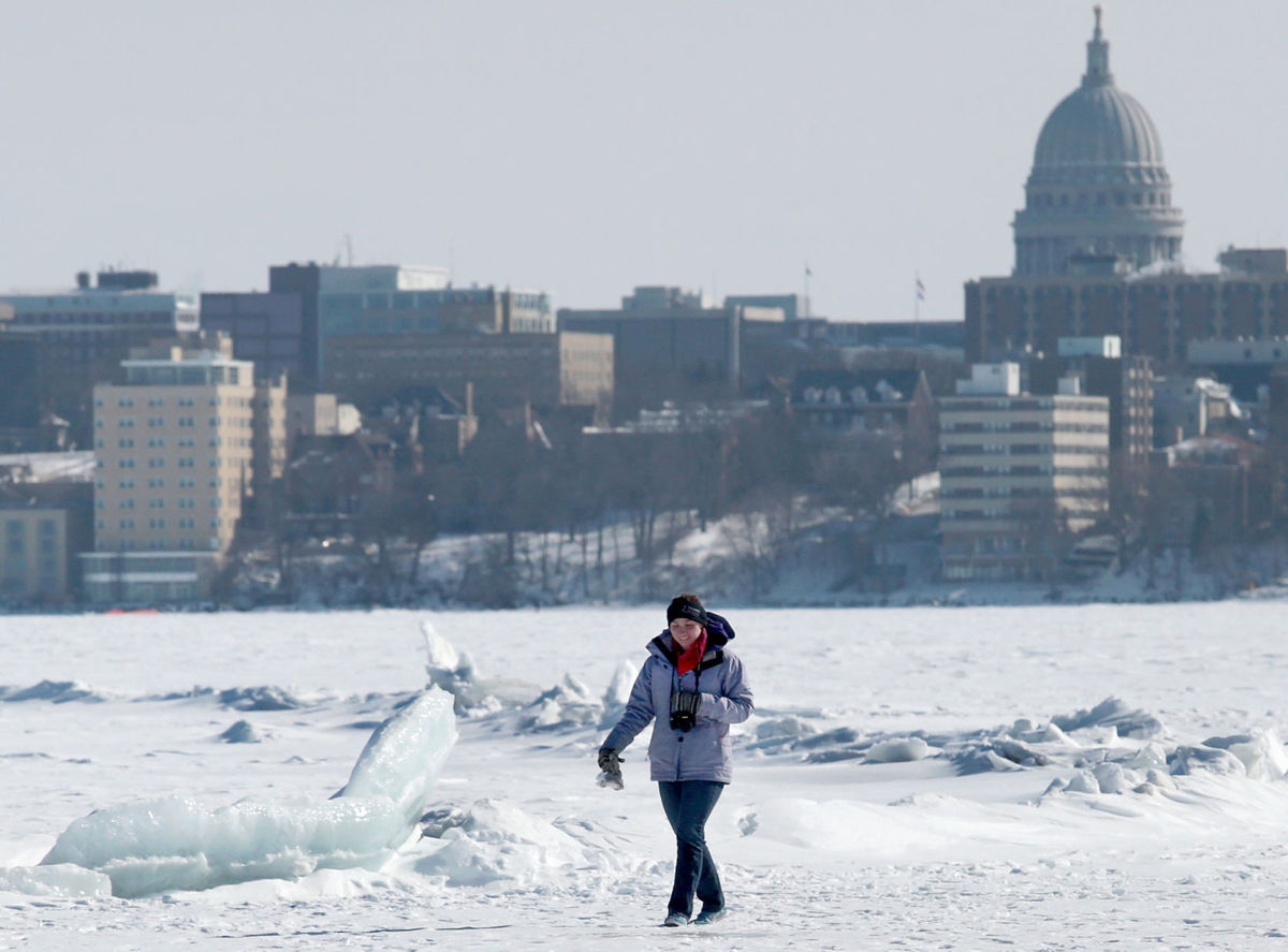
This warmth will ensure that the freeze of Lake Mendota will be delayed well into January, perhaps long enough that we will make a run at the latest freeze ever, which is Jan. 30. Stay tuned for more updates on what may be taking shape as a strange, record-setting winter.

Category: Meteorology, Seasons

Comments Off on Is our December abnormally warm?

When is the winter solstice?

The winter solstice (In Latin, sol, “Sun,” and stice, “come to a stop”) is the day of the year with the fewest hours of daylight. In 2015, this occurs for the Northern Hemisphere on Dec. 21 at 10:48 p.m. CST.

As Earth orbits the sun, its axis of rotation is tilted at an angle of 23.5 degrees from its orbital plane. Because Earth’s axis of spin always points in the same direction — toward the North Star — the orientation of Earth’s axis to the Sun is always changing as Earth orbits around the Sun.

As this orientation changes throughout the year, so does the distribution of sunlight on Earth’s surface at any given latitude. This links the amount of solar energy reaching a location to the time of year and causes some months of the year to always be warmer than others — in other words, the seasons.

On the Northern Hemisphere’s winter solstice, the northern spin axis is pointed away from the Sun and latitudes north of the Arctic Circle (66.5°N) have 24 hours of darkness.

The winter solstice is often referred to as the first day of winter. But there are other definitions of winter.

For example, the beginning of winter might be defined on the calendar day, on average, when precipitation has an equal chance of falling as rain or snow. For Madison, that calendar day is Nov. 15.

Meteorologists often define the three months of winter as December, January and February — the coldest months of the year.

Category: Meteorology, Seasons

Comments Off on When is the winter solstice?

What does it take for Lake Mendota to freeze?

Kayla Powell of Lacrosse makes her way past a collection of ice heaves on Lake Mendota in February.   With this month's warm temperatures, it could be a while before the lake freezes again.  Photo credit:   John Hart, State Journal archives

Kayla Powell of Lacrosse makes her way past a collection of ice heaves on Lake Mendota in February. With this month’s warm temperatures, it could be a while before the lake freezes again. Photo credit: John Hart, State Journal archives

The climatological ice-on date for Mendota is Dec. 19 but the actual ice-on date in any given winter is highly variable. Given our warm autumn this year, it is likely we will experience a later than normal ice-on date.

Right now the lake’s water temperature is about 7C (45 degrees Fahrenheit) and, importantly, that temperature is nearly uniform throughout the water column. Such uniformity in temperature started about Oct. 1 this year, according to data from the Integrated Nowcast/Forecast Operation System (INFOS) for the Yahara Lakes (www.infosyahara.org/temp_mendota). At that time, the water temperature was about 15C (59 Fahrenheit). Thus, in the past two months, the lake water has cooled by 8C (14 degrees Fahrenheit).

Such cooling requires an enormous amount of energy to be extracted from the lake. Knowing the size of the lake (39.85 million square meters), its average depth (12.7 meters) and the density of water (1000 kg per cubic meter), we know that 507 billion kg of water reside in Lake Mendota. Given the 14-degree temperature change and the fact that 4200 joules of energy must be extracted from each kilogram of water to lower its temperature 1C, we know that 1.7 quadrillion joules of energy have been extracted from the lake since Oct. 1.

Since there are 3.6 million joules in every kilowatt hour (kwH) and the Madison metro area uses about 79 million kwH of energy on a typical January day, we can calculate that the amount of energy thus far extracted from Lake Mendota to get it to its current temperature is enough to power the entire Madison metro area for nearly 60 winter days.

Additionally, it is not until the water temperature cools another 3C (requiring extraction of the equivalent of another 23 days of energy) that the lake is even ready for the additional surface cooling that eventually leads to freezing. It is easy to overlook the fact that truly enormous amounts of energy are being transferred from water to atmosphere before our eyes.

Category: Meteorology, Seasons

Comments Off on What does it take for Lake Mendota to freeze?

Can it be too cold to snow?

Atop an Antarctic mountain

Atop an Antarctic mountain

No, it is never too cold to snow.

It snows in Antarctica — where temperatures are minus 70 degrees — though only a few tenths of an inch.

To get snow, the always-present water vapor in the atmosphere has to be converted to ice crystals. How much water vapor is in the atmosphere depends on the air temperature.

The maximum amount of water vapor in the atmosphere is a function of the air temperature. So the colder the air, the less water vapor is present in the atmosphere. Therefore, large snowfall amounts are not associated with extremely cold temperatures.

Snowfall requires vertical motion in the atmosphere, or lifting. Warm moist air above the surface may be lifted by a front. As the air rises it expands and cools because air pressure decreases with altitude.

As the air rises, expands and cools, the relative humidity in the atmosphere increases and eventually cloud particles form. If the air is below freezing they will be ice crystals. As the lifting continues the crystals grow and fall from the cloud, and if they reach the surface, that is snow.

Snowfall can occur at very cold conditions as long as there is some source of moisture and some lifting. Very cold days in Wisconsin often are associated with high-pressure weather systems where downward motions prevail, preventing the formation of clouds and precipitation.

Heavy snowfalls generally occur around 15 degrees or warmer, though still below freezing, since the warmer air generally has more water vapor.

Category: Meteorology, Seasons

Comments Off on Can it be too cold to snow?

How do we measure an official snowfall for Madison?

Suka the polar bear enjoys her first Wisconsin snowfall in the Arctic Passage exhibit at Vilas Zoo on Saturday.  Accurate and precise measurement of snow accumulation Is a difficult task.  The trick is finding a good place to measure and a firm surface upon which to set your ruler.  Photo credit: Amber Arnold, Wisconsin State Journal

Suka the polar bear enjoys her first Wisconsin snowfall in the Arctic Passage exhibit at Vilas Zoo on Saturday. Accurate and precise measurement of snow accumulation Is a difficult task. The trick is finding a good place to measure and a firm surface upon which to set your ruler. Photo credit: Amber Arnold, Wisconsin State Journal

The trick in measuring snow consistently is simply finding a good place to measure and a firm surface upon which to set your ruler.

At official stations, a snow board (a square piece of wood 16 inches on a side and painted white) is employed.

Other surface options are wooden decks, picnic tables, and cars. Your measurement location should be 20 to 30 feet away from the house with an unobstructed view of the sky.

Sidewalks are not recommended as they tend to accelerate melting of the snow.

Grass is also suboptimal as snow tends to sit up on top of the blades of grass, while the ruler goes down to the ground.

When the wind blows and the snow drifts, accurately measuring snow accumulation is even more challenging as drifting becomes a problem.

To deal with drifting snow, measurements must be made at various places and then averaged to get what is considered a representative measurement.

The liquid equivalent of accumulated snow can be measured with the standard rain gauge — an 8-inch diameter cylinder that collects precipitation. The conversion from liquid equivalent to snow depth varies with every storm and is broadly temperature dependent.

Thus, it is really difficult to re-create a snowfall distribution from liquid equivalent observations over an area even as small as Dane County.

Discussions are underway currently to terminate the snowfall recording at Dane County Regional Airport.

This would be a terrible blow to the climate record of Madison, and we sincerely hope a new agreement can be worked out between the FAA and other interested parties.

We will at least have official records through this snow season.

Category: Meteorology, Seasons

Comments Off on How do we measure an official snowfall for Madison?