When is the summer solstice?

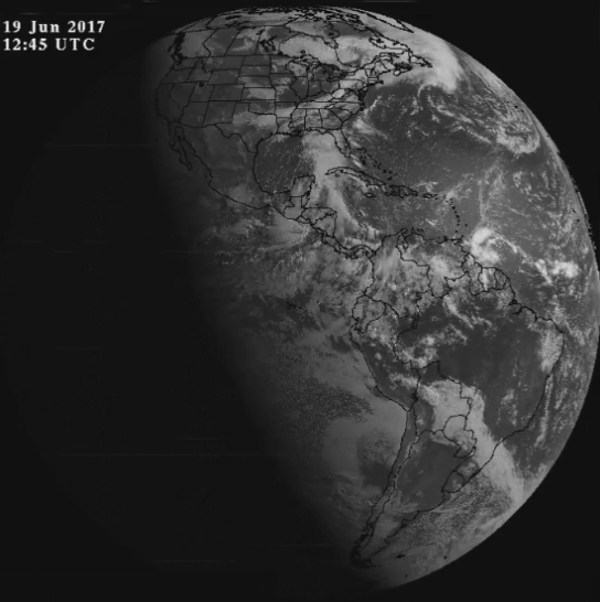
This full disk image, one day before the 2017 summer solstice, illustrates the abundance of daylight in the northern hemisphere.

The summer solstice in the Northern Hemisphere is the day when the sun is farthest north.

In 2017, this occurs Tuesday at 11:24 p.m. Central Time.

As Earth orbits the Sun, its axis of rotation is tilted at an angle of 23.5 degrees from its orbital plane. Because Earth’s axis of spin always points in the same direction — toward the North Star — the orientation of Earth’s axis to the Sun is always changing as Earth orbits around the Sun.

As this orientation changes throughout the year, so does the distribution of sunlight on Earth’s surface at any given latitude. The summer solstice is the day of the year with the most daylight.

On the Northern Hemisphere’s summer solstice, the northern spin axis is tilted toward the sun and latitudes north of the Arctic Circle (66.5 degrees N) have 24 hours of daylight.

At the summer solstice, the sun reaches its highest point in the sky and daylight is longest. However, our earliest sunrise in Madison occurs in mid-June while our latest sunset occurs in late June.

So, while the summer solstice has the longest daylight hours, that day does not correspond to the earliest sunrise or the latest sunset. The reason that the earliest sunrise and latest sunset do not occur on the summer solstice is a combined effect of the tilt of Earth’s axis and the elliptical path of Earth around the sun.

On our solstice, the sun rises and sets farthest north of due east and due west. The farther the sun sets from due west along the horizon, the shallower the angle of the setting sun. That means a longer duration for sunset at the solstices.

Steve Ackerman and Jonathan Martin, professors in the UW-Madison department of atmospheric and oceanic sciences, are guests on WHA radio (970 AM) at 11:45 a.m. the last Monday of each month.
Category: Seasons

Comments Off on When is the summer solstice?

What is a derecho?

A derecho (pronounced deh-RAY-cho, a Spanish word meaning “straight ahead”) is an hours-long windstorm associated with a line of severe thunderstorms.

It is a result of straight-line winds, not the rotary winds of a tornado — hence its name. Derechos in the United States are most common in the late spring and summer (May through August).

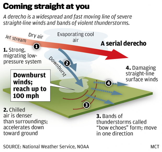
The extreme winds of a derecho — up to 150 mph in the strongest storms — come about in the following way. Derechos are often associated with a quasi-stationary front in mid-summer. If the atmosphere just north of the front is very unstable, the front may trigger rapidly developing thunderstorms. A line of thunderstorms that forms in the vicinity of the stationary front can, via its cold downdrafts, drag down high-speed air from above. This can cause the high winds of a derecho.

At the same time, the high winds push the line of thunderstorms outward, causing it to bend or “bow.” This results in a bow echo image on weather radar. Once they get going, derechos can cover lots of territory — up to 1,000 miles.

Derechos leave significant property damage in their wake, even flattening entire forests. In some cases, derechos wreak as much havoc as a hurricane or tornado.

The June 29, 2012, derecho swept across from U.S. from west of Chicago to the East Coast, leaving as many as 5 million households without power. The storm traveled at speeds of more than 60 mph, with wind gusts approaching 80 mph. At least 22 people were killed.

About 40 percent of all thunderstorm-related injuries and deaths occur because of derechos.

Category: Meteorology, Phenomena, Severe Weather

Comments Off on What is a derecho?

Is the weather nicer on Memorial Day or Labor Day?

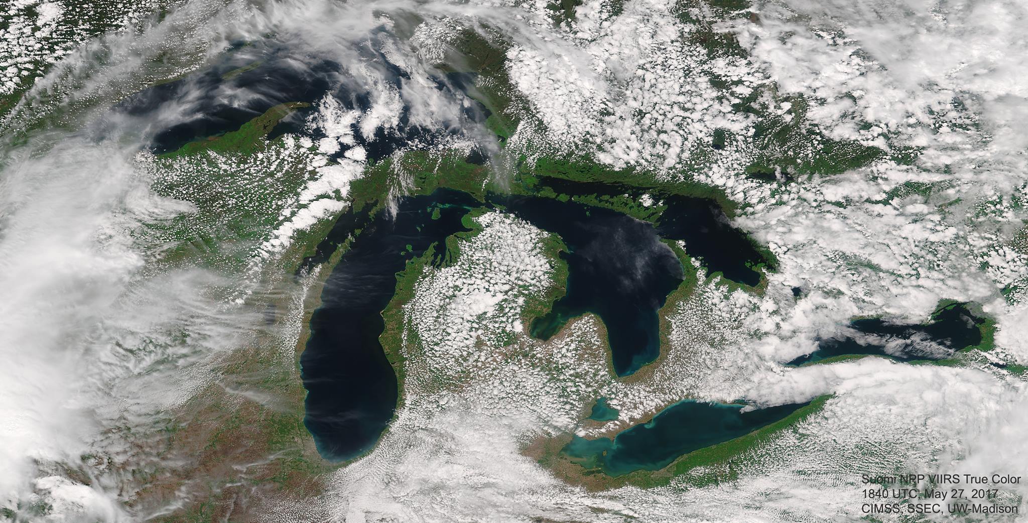
Suomi NPP VIIRS view of the Great Lakes Region on Memorial Day Weekend 2017 (5/27)

Memorial Day traditionally marks the beginning of the summer, while Labor Day marks the end.

People are bound to have their own recollections and opinions about which weekend more reliably delivers agreeable weather here in southern Wisconsin, and those opinions can be colored by many non-meteorological influences.

If forced to opine on this question while sticking to strictly meteorological factors, we would suggest that Labor Day weekend’s weather is more reliably summerlike.

The reason for this comes directly from the fact that Memorial Day comes as winter is ending and Labor Day as winter approaches.

As the winter ends, the entire Northern Hemisphere gradually warms up and the leftover cold air from the polar regions is gradually bled away to lower latitudes where it disappears.

This “bleeding” of cold air occurs in distinct blobs, known as cutoff lows. It is verifiable that there are many more cutoff lows in the hemisphere in May than in September.

These cutoffs can sometimes remain over a location for days at a time and negatively impact the local weather by engendering conditions that favor the development of thundershowers and persistent clouds, not to mention below normal temperatures. Our cooler weather early last week was related to such an event.

Since these features are more common in May, the weather is more prone to these undesirable unsettled periods this month than in September.

Category: Meteorology, Seasons

Comments Off on Is the weather nicer on Memorial Day or Labor Day?

Did someone predict the recent Wisconsin tornado?


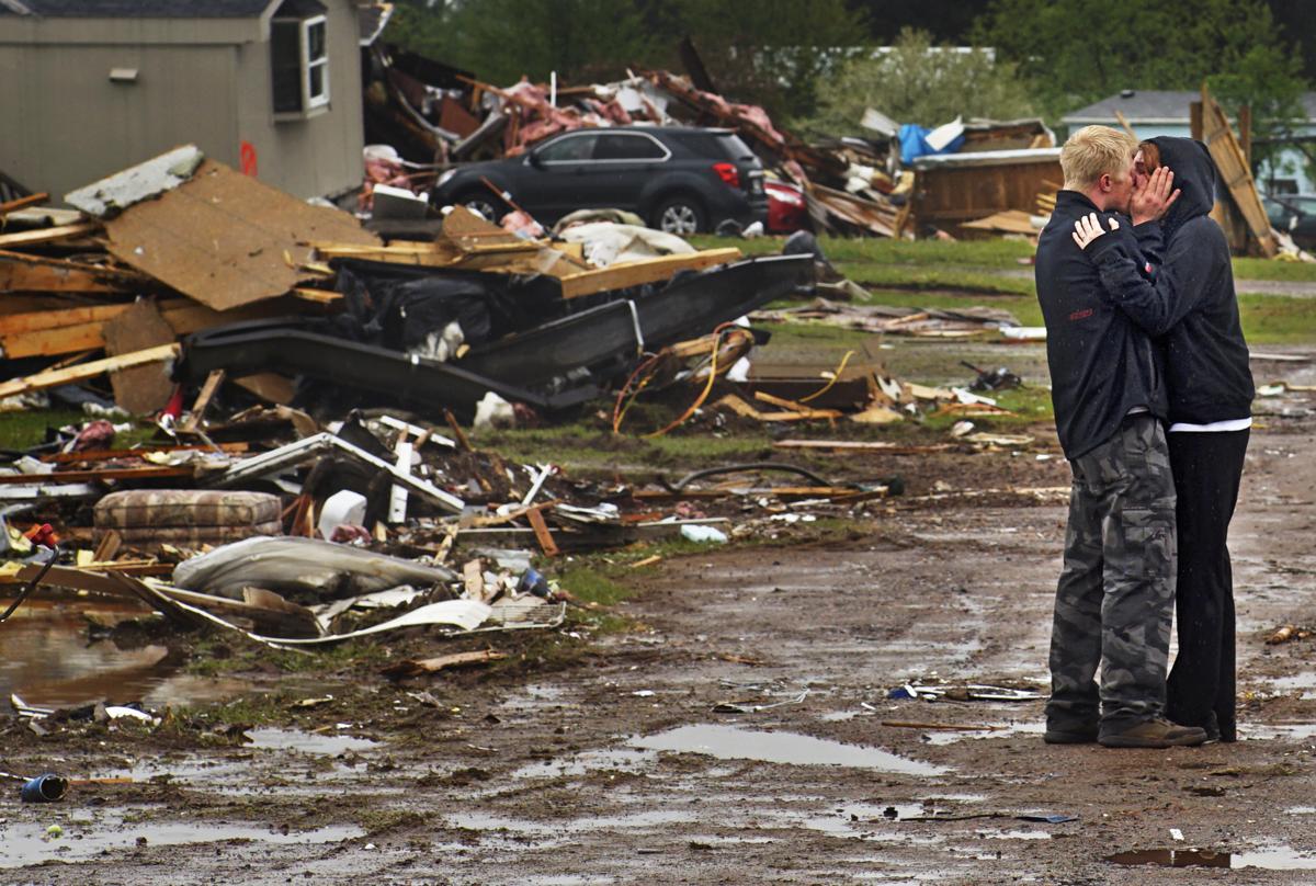
Ron Bloomberg, who witnessed victim and neighbor Eric Gavin’s body being recovered, embraces his girlfriend as he returns to his home in Chetek, Wis., after a tornado flattened a trailer park and nearby trees. (Richard Tsong-Taatarii/Star Tribune via AP)

We cannot yet forecast tornado occurrence with any accuracy. One problem is the small size of a tornado, which is a narrow column of strong winds that rotate around a center of low pressure.

Over the last 60 years, forecasts of the development of large-scale low-pressure systems, which often organize the ingredients needed to form a tornado, have steadily improved. Because of these advances, meteorologists are better able to predict those conditions a few days in advance, enabling forecasters to identify counties where there is a threat of severe weather sometimes as many as three days in advance. Two days in advance of the recent EF-2 tornado (later upgraded to EF-3) that hit southeastern Polk County, the National Weather Service’s Storm Prediction Center’s convective outlook issued a slight-risk for the area.

For a thunderstorm to produce a tornado requires warm humid air near the surface with cold dry air above. These conditions make the atmosphere very unstable, in the sense that once air near the ground is forced upward, it ascends freely and quickly (like a helium balloon), cools as it expands and forms a storm. Severe thunderstorm conditions also include a layer of hot, dry air between the warm, humid air near the ground and the cool dry air aloft. This hot layer acts as a lid that allows the sun to further heat the warm, humid air — making the atmosphere even more unstable. In the central U.S., such air is created over the plateau of Mexico and sent northeastward over the Great Plains.

To form a tornado, the host thunderstorm must also rotate. This happens in a storm when wind at the ground is moving in a different direction and speed than the air above. The change in wind speed and direction with height is known as wind shear. Both wind shear and atmospheric instability are needed for tornado formation.

Recent advanced models have been able to simulate development of a tornado, a first step to better predictions. Advances in radar technologies have helped to identify storms that are producing a tornado, or about to produce one. Based on observations from such advanced technologies, the Storm Predication Center (SPC) issued a warning about one hour before the Polk County tornado, and the NWS issued a tornado warning about 10 minutes before the first sighting of a funnel cloud.

Steve Ackerman and Jonathan Martin, professors in the UW-Madison department of atmospheric and oceanic sciences, are guests on WHA radio (970 AM) at 11:45 a.m. the last Monday of each month.
Category: Meteorology, Severe Weather

Comments Off on Did someone predict the recent Wisconsin tornado?

Is the weather in Madison more extreme than other locations in the U.S.?

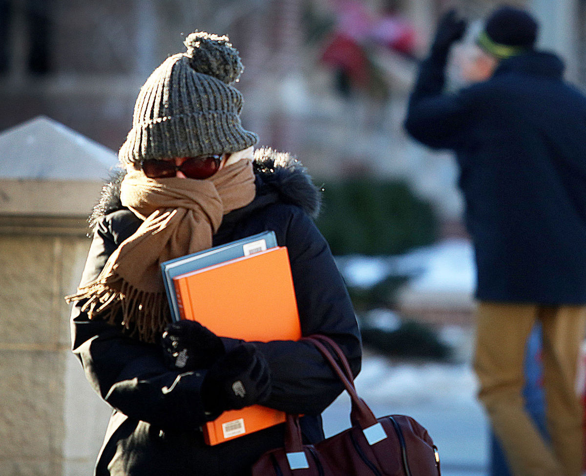
Spend an entire year in Madison, and you’ll likely experience a huge swing in temperatures and humidity, thanks to the area’s continental climate. (Photo credit: John Hart, State Journal archives)

Sitting nearly in the middle of the vast North American continent, Madison has what is known as a continental climate. Continental climates are characterized by large annual extremes in temperature and humidity as well as very distinct seasons.

The continental nature of Madison’s climate is what makes a year’s worth of weather in Madison usually a lot more varied than a year’s worth in, say, Seattle.

There is an astounding 144-degree difference between the all-time highest temperature in Madison (107 degrees on July 13, 1936) and the all-time lowest (37 below zero on Jan. 31, 1951). In addition, the amount of water vapor in the air can range from the barely detectable level in the midst of a deep winter cold spell to as much as 3.5 percent of every breath you take during a severe July heat wave.

No matter what the season, the vast majority of the invisible water vapor in the atmosphere is contained in the lowest mile or two from its source at the surface.

At any given time, the Earth’s atmosphere contains 37.5 million billion gallons of water vapor – enough to cover the entire surface of the planet with 1 inch of rain if condensed. This amount is recycled, through evaporation powered by the sun, 40 times each year in what is known as the hydrologic cycle.

In each of these 40 cycles, enough energy is expended to power the United States – the largest consumer of energy in the world – for 3,441 years, a truly astounding amount of energy.

Category: Climate, Seasons

Comments Off on Is the weather in Madison more extreme than other locations in the U.S.?