Winter in July?

On more than one occasion in this column we have commented on the areal extent of air colder than 23 degrees about 1 mile above the ground as a measure of the extremity of winter.

In the middle of January, about 68 million square kilometers of the Northern Hemisphere are covered by air that cold at that level. Between about July 5 and July 20 that area shrinks to zero, and the complete absence of such air lasts only a very few days.

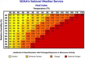
We are just past the point in this summer where that area is beginning to increase again. Thus, despite the fact that we have been through a couple of really hot (and humid) weeks this July, the return of winter has already begun in terms of this measure. This is largely because the number of daylight hours has already begun to decrease — noticeably here in Madison.

Above the Arctic Circle, the sun travels a tilted circle around the sky on the summer solstice but never sets below the horizon.

At every latitude north of 66.5N, however, the sun was out for 24 hours long on the day of the Summer Solstice (June 21). Ever since, the specter of nighttime has been creeping poleward with the daylight decreasing ever so slightly just above the Arctic Circle. The associated nighttime cooling is greater during a longer night, resulting in the gradual increase in the amount of cold air covering the Northern Hemisphere.

So, if these past couple of weeks have been a bit too much for you, perhaps some solace can be found in the fact that the tide is already, however imperceptibly, beginning to turn.

Category: Meteorology, Seasons

Comments Off on Winter in July?

What is the heat index?

NOAA’s Heat Index

The heat index indicates how hot it feels.

It is expressed as a function of air temperature and the relative humidity. The heat index temperature is for standing in the shade and light winds; when exposed to direct sunlight, the heat index value can be increased by up to 15 degrees.

When our bodies get hot we cool down by sweating. The sweating does not directly cool our bodies; it is the evaporation of the sweat that cools us down. If the air has a high humidity, then the rate of evaporation is reduced. This hampers the body’s ability to maintain a nearly constant internal body temperature. This is why we are uncomfortable on hot, muggy days.

When the temperature is high but the relative humidity is low, the heat index can be less than the actual temperature. This is because cooling by evaporation of sweat is very efficient in these situations. However, high relative humidities prevent evaporation and make it seem hotter than it really is because our bodies cannot cool down. In these cases, the heat index is greater than the actual temperature.

The National Weather Service (NWS) initiates alert procedures when the heat index is expected to exceed 105 to 110 degrees, depending on local climate, for at least two consecutive days. The NWS will issue a heat advisory when the heat index is predicted to be 100 degrees. You are then advised to limit vigorous outdoor activity and drink plenty of fluids. Never leave children or pets in a locked car.

A heat wave is a period of abnormally and uncomfortably hot and usually humid weather. The World Meteorological Organization defines a heat wave as when the daily maximum temperature for more than five consecutive days exceeds the average maximum temperature by 9 degrees.

Category: Meteorology, Seasons, Severe Weather

Comments Off on What is the heat index?

What is mud rain?

Mud rain is rain that contains a noticeable concentration of particles of sand or dust.

Saharan dust collected in a rain gauge in the Caribbean.
Credit:@CLIMATEwBORDERS

The soil can be of local origin or it can originate from very distant regions. As rain falls through the dust layer, the raindrops collect the soil particles. When the rain droplets hit objects on the ground, the water evaporates and leaves behind dry mud spots.

Another consequence can be health hazards to those with respiratory issues because, as the fine particles of dust settle out, they can reduce the quality of the air we breathe.

At the end of June, a large dust cloud arrived in North America from the Sahara Desert. Micrometer-sized soil particles from the desert were lifted by the wind to high altitudes and transported over thousands of miles. The dust was carried by atmospheric circulation patterns across the Atlantic Ocean. Satellite observations tracked the movement of this dust, or aerosol, from Africa, across the Atlantic Ocean and into the Upper Midwest. 

 Aerosol Optical Depth (AOD) measured by satellites outlined dust flowing from Africa over the Atlantic Ocean to North America in June 2020. Credit: NASA

Desert soil is carried across the ocean every year, but this particular June dust plume spanned thousands of miles. Iron and other nutrients in dust can lead to phytoplankton blooms as the dust settles into nutrient-limited waters. As the dust covered multiple regions of the southern U.S., it turned daytime skies very hazy and sunsets red and orange.

Dust can be transported across the globe. Desert dust from the Sahara and Gobi deserts has been observed on the ice sheet of Greenland. Ice cores in Greenland provide a history of the dust deposition as they appear as layers in the ice. The mineralogy of the dust in the ice allows scientists to trace the desert of origin. The source also allows scientists to determine global wind patterns from thousands of years ago.

Steve Ackerman and Jonathan Martin, professors in the UW-Madison Department of Atmospheric and Oceanic Sciences (AOS), are guests on WHA radio (970 AM) at 11:45 a.m. the last Monday of each month.

Category: Meteorology, Phenomena

Comments Off on What is mud rain?

What is the longest lightning bolt?

GOES East (GOES-16) data used to document the longest single lightning flash on record which occurred across southern Brazil in October 2018. (Credit: NOAA)

The World Meteorological Organization, or WMO, investigates and certifies meteorological records. On Friday, a WMO committee of experts confirmed a new world record for the longest single lightning flash. The single flash occurred on Oct. 31, 2018 and covered a horizontal distance of 440.6 miles, plus or minus 5 miles, across parts of southern Brazil.

This new record for the longest detected distance for a single lightning flash smashes the previous record of 199.5 miles, which occurred on June 20, 2007 across Oklahoma.

The WMO committee also certified a new record for the greatest duration for a single lightning flash: 16.73 seconds over northern Argentina on March 4, 2019. The new record for duration of a single lightning flash is more than double the previous record of 7.74 seconds on Aug. 30, 2012 over France.

These long flashes have come to be known as “megaflashes” and are lightning discharges that reach more than 50 miles in length. They originate in massive convective storm complexes known as mesoscale convective systems.

New satellite observations to study lightning were used to help validate the new record. It is these new satellite technologies that enable the observation and study of these long-lived lightning events, which previously could not be measured. The space-based instruments also provide near-global coverage of lightning flashes. These measurement capabilities are relatively new, and thus it is likely that these new records will fall as lightning detection technology continues to improve.

Lightning is very dangerous. While your chances of getting hit by lightning are only about 1 in a million in a given year, it is good to keep some safety tips in mind. The National Weather Service advocates the simple rule: “When thunder roars, go indoors!”

Category: Meteorology, Phenomena, Severe Weather

Comments Off on What is the longest lightning bolt?

Does the sunset last longer around the summer solstice?

This June 20 GOES East satellite image from illustrates why the North Pole receives 24 hours of daylight on the summer solstice and the South Pole receives zero. This year it also revealed dust in the Saharan Air Layer (SAL). (Credit: SSEC)

Yes. The summer solstice — in Latin, “sol,” or “sun,” and “stice,” or “come to a stop” — is the day of the year with the most daylight.

The first day of the astronomical Northern Hemisphere summer is the day of the year when the sun is farthest north. In 2020, this occurred at 4:44 p.m. Saturday.

As Earth orbits the sun, its axis of rotation is tilted at an angle of 23.5 degrees from its orbital plane. Because Earth’s axis of spin always points in the same direction — toward the North Star — the orientation of Earth’s axis to the sun is always changing as Earth orbits around the sun. As this orientation changes throughout the year, so does the distribution of sunlight on Earth’s surface at any given latitude.

We define sunset as the time the sun sinks below the horizon. The sun rises and sets farthest north at our summer solstice. The farther the sun sets from due west along the horizon, the shallower the angle of the setting sun. That translates to a longer duration for sunset at the solstice.

While the summer solstice is the day of the year with the most daylight, the earliest sunrise and latest sunset do not occur on the summer solstice. The earliest sunrise occurred about a week ago and the latest sunset occurs later in June.

The time when the sun reaches its highest point in the sky is called solar noon. Solar noon rarely occurs exactly at clock noon; it’s sometimes before and sometimes after. According to our clocks, solar noon comes later on our June solstice than it does one week before. Therefore, according to our clocks, the sunrise and sunset times also come later.

Category: Seasons

Comments Off on Does the sunset last longer around the summer solstice?