What happens to the wintertime cold pool in summer?

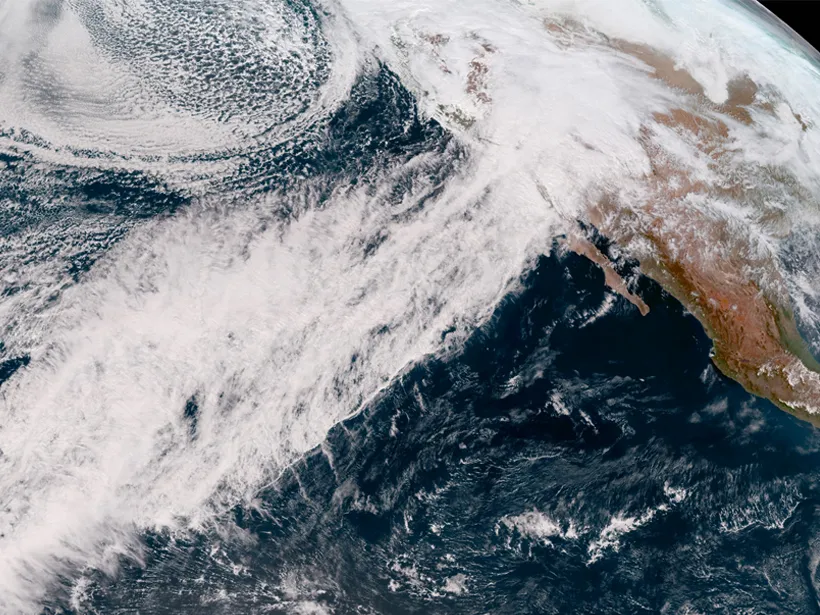
We have commented a number of times in the past few years about the areal extent of the hemispheric cold pool of air at 850 mb — about 1 mile above the surface — during the winter. As one might expect, that pool expands dramatically from October through February and then begins to contract as we move toward spring and summer.

Our analysis uses the minus 5 degrees Celsius (23 degrees Fahrenheit) isotherm (line of constant temperature) and has shown that the average winter cold pool area has systematically shrunk in the past 75 years.

One might reasonably wonder if this cold pool survives at all during the height of Northern Hemisphere summer. As it turns out, some summers have a number of days in mid-July on which there is absolutely no air at 850 mb that is as cold as minus 5 Celsius. Roughly half of the past 75 years have had such a “vanishing” cold pool, with many of the other years getting very close to vanishing.

The calendar date on which the lowest areal extent is observed in a given summer varies from around July 4 to as late as July 23. Thus, later this week we will likely be close to the day of the minimum area for the year.

With no intention to distract from the pleasant summer we are all presently enjoying, reaching the annual minimum this week means that by the beginning of next week, the cold pool will begin its slow, inevitable expansion again — culminating in the coldest week of the year in late January when it will cover nearly 70 million square kilometers.

Enjoy the summer — it can’t last.

Steve Ackerman and Jonathan Martin, professors in the UW-Madison department of atmospheric and oceanic sciences, are guests on WHA radio (970 AM) at 11:45 a.m. the last Monday of each month. Send them your questions at stevea@ssec.wisc.edu or jemarti1@wisc.edu.

Category: Climate, Meteorology, Seasons

Comments Off on What happens to the wintertime cold pool in summer?

Has this been an unusually hot start to summer?

The recent stretch of warm, humid weather has got some people wondering if we have gotten off to an unusually hot start to summer this year in Madison.

There are a couple of ways one could approach that question. One way is to consider the departure from average for our daily high temperatures since May 1. From that perspective, we have been consistently warmer than normal with May daily highs averaging 3.2 degrees above normal and, June (through Friday) averaging 1.9 degrees above normal.

Another, somewhat more dramatic, way to assess the early heat is to consider the number of days at or above 90 degrees this year. Through June 24, we have already had 10 such days this summer — we had a record five such days in May for the first time in Madison’s history. The average number for a summer in Madison is 13, so we are nearly already there. The all-time Madison record for 90-plus days is 39, set in 1955.

You might remember the summers of 1988 and, more recently, 2012 when Madison had a near-record 35 days with a high temperature at or above 90. By June 27, 1988, we had recorded nine such hot days, the full complement for all of June that year. By June 27, 2012 we had only recorded five days at 90 or above, and in 1955, we had had only one — so we are ahead of the paces set in all three of these remarkable years.

July 2012 had 18 days that were that hot, the bulk of those 18 coming in two streaks of six and seven consecutive 90-plus days. If we are to make a run at 30 or more hot days this summer, we will need a couple extended heat waves such as those from 2012. It will be interesting.

Steve Ackerman and Jonathan Martin, professors in the UW-Madison department of atmospheric and oceanic sciences, are guests on WHA radio (970 AM) at 11:45 a.m. the last Monday of each month. Send them your questions at stevea@ssec.wisc.edu or jemarti1@wisc.edu.

Category: Climate, History, Seasons

Comments Off on Has this been an unusually hot start to summer?

What is an atmospheric river?

An atmospheric river system that drenched parts of California on 14 February 2019— dropping more than 25 centimeters of rain at Palomar Observatory northeast of San Diego, for example, in the observatory’s wettest day on record—is seen in this image from the National Oceanic and Atmospheric Administration’s GOES West satellite. (Image credit: NOAA)

Atmospheric rivers are relatively narrow regions in the atmosphere — typically 250 to 375 miles wide and well over 1,000 miles long.

These sky rivers transport water vapor outside of the tropics to mid-latitude and polar regions. We estimate that 90% of Earth’s north to south water vapor transport is done through atmospheric rivers.

An atmospheric river is identifiable in imagery from weather satellites, appearing as elongated tendrils of moisture stretching from the tropics to the mid-latitudes. This moisture laden air moves away from the Equator and can carry enough water vapor, that if condensed to liquid form, is approximately equivalent to the amount of water carried by 25 Mississippi Rivers.

When an atmospheric river flows over land, extreme flooding events can occur, often through interactions with mid-latitude weather systems. Think of an atmospheric river as a conveyor belt that provides huge amounts of tropical moisture into mid-latitude weather systems, intensifying their rainfall. Extreme, or prolonged, precipitation can create floods, induce mud slides, and cause catastrophic damage to life and property.

Most rivers in the sky, however, are weak and simply provide beneficial rain or snow that is crucial to the water supply of a region. Atmospheric rivers are responsible for a large percentage of the rain and snow in the western United States during winter. When these rivers are forced up the sides of the Sierra Nevada mountains in California and Nevada, the water vapor is condensed into liquid and solid form, bringing much needed rains to the area.

Categorizing the flow of moisture by an atmospheric river can be a useful way to gage the likely impact of these features on precipitation. For example, an Atmospheric River Category 1 (AR Cat 1) is the weakest category and is considered primarily beneficial in terms of rainfall. An AR Cat 2 is moderate and in most situations beneficial, but can be hazardous if the resulting precipitation lasts a long time. The strongest category is AR Cat 5 and that is an exceptional and primarily hazardous event.

Steve Ackerman and Jonathan Martin, professors in the UW-Madison department of atmospheric and oceanic sciences, are guests on WHA radio (970 AM) at 11:45 a.m. the last Monday of each month. Send them your questions at stevea@ssec.wisc.edu or jemarti1@wisc.edu.

Category: Meteorology, Phenomena, Weather Dangers

Comments Off on What is an atmospheric river?

Did weather forecasting play a role in D-Day?

American assault troops move onto a beachhead code-named Omaha Beach, on the northern coast of France, on June 6, 1944, during the Allied invasion of the Normandy coast. The success of the invasion was extraordinarily dependent on weather conditions. (Photo credit: Associated Press)

Last week was the 78th anniversary of the Allied invasion of Europe that began with the landings on the beaches at Normandy. The combined land, air and sea assault of June 6, 1944, remains the largest such event in history.

The success of the invasion was extraordinarily dependent on weather conditions. More than three months before the invasion, a combined British and American forecasting team began rigorous forecast exercises designed to iron out the physical and logistical kinks of such a coordinated effort.

As June drew near, the nature of this collaboration was still problematic as the two groups employed vastly different methods in fashioning the requisite three- to five-day forecasts. The British were attempting to make such forecasts based upon the understanding of atmospheric dynamics that had grown substantially during the war. The Americans were employing a method based on a statistically based search through old weather data for historical analogues that could be used to guide the forecast.

To maintain secrecy, a large portion of the Allied fleet was squirreled far away in northern Scotland. Consequently, five days of lead time was required to mobilize these forces. Thus, Gen. Dwight D. Eisenhower needed to know by May 31 whether the first week of June, the prospective target for the invasion, would provide favorable weather.

The forecasters foresaw a break in that year’s unusually stormy late spring and suggested June 5 would work. As the day approached, the team realized that a one-day postponement would offer better conditions, prompting Eisenhower to make the fateful decision to invade on June 6, under barely acceptable conditions.

Had the Allies delayed, the combination of lunar cycle, tides and weather almost certainly would have postponed the invasion for more than a month, likely costing the effort the tremendous advantage of secrecy.

Steve Ackerman and Jonathan Martin, professors in the UW-Madison department of atmospheric and oceanic sciences, are guests on WHA radio (970 AM) at 11:45 a.m. the last Monday of each month. Send them your questions at stevea@ssec.wisc.edu or jemarti1@wisc.edu.

Category: History, Meteorology

Comments Off on Did weather forecasting play a role in D-Day?

How can you report tornadoes?

National Weather Service’s Skywarn logo
(Image credit: weather.gov)

The National Weather Service is always looking for trained volunteers to provide severe weather reports, including reports of tornadoes.

Its spotter training sessions are free and last between 90 minutes and two hours. Trained volunteers receive certificates and are added to the National Oceanic Atmospheric Administration, or NOAA, database of weather spotters. They also receive a Spotter ID. A virtual training option is also available.

The spotter program is informal and voluntary. Observations can be made as spotters carry out their daily routines.

The training covers the basics of thunderstorm development and fundamental storm structure. Spotters learn to identify potential severe weather features and how to report the information. Basic severe weather safety is also covered.

SKYWARN is a NWS volunteer program with more than 350,000 trained severe weather spotters. Volunteer spotters relay their severe weather reports to the weather service as they observe them. Their observations are used by forecasters to track storms and alert the public to dangerous weather situations.

NOAA is also seeking volunteers to help collect additional data about people’s severe weather experiences. Their new Tornado Tales citizen science tool is an online survey in which participants submit anonymous reports of their tornado experiences. The information will be used by NOAA’s National Severe Storms Laboratory (NSSL) to better understand how people receive, interpret and respond to tornado information from NOAA.

NOAA collects a lot of science data about storms from satellites, radars and weather stations. It has less data about what people do when tornadoes strike, or are about to strike. Tornado Tales — go.madison.com/TalesTornado — gathers information about what people affected by severe weather are really doing. Hopefully, this will generate understandings that NOAA social scientists can use to refine messaging about tornado warnings and watches.

Steve Ackerman and Jonathan Martin, professors in the UW-Madison department of atmospheric and oceanic sciences, are guests on WHA radio (970 AM) at 11:45 a.m. the last Monday of each month. Send them your questions at stevea@ssec.wisc.edu or jemarti1@wisc.edu.

Category: Meteorology, Severe Weather, Weather Dangers

Comments Off on How can you report tornadoes?