Why does the wind adversely affect over-the-air television transmission?

553300aabb122_image

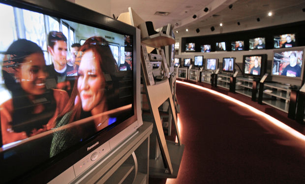
MIKE DEVRIES — The Capital Times archives

If you do not have cable, your digital television reception can be affected by storms and high winds.

Antennas intercept the TV signal, which travels as a low-energy electromagnetic wave. The TV waves that are intercepted by the metal antenna cause electrons to move and that generates an electric current — which gets converted to the TV picture. If the TV carrier wave gets disturbed, your TV picture can be affected.

For the best digital TV reception, your antenna should have a clear line of sight to the TV broadcast tower. But many homes do not have that direct line. Any large structures can interfere with the signal. Trees are a common obstacle. On calm days, trees are not much of a problem but on windy days, strong winds cause the trees to sway.

Signals from the TV broadcast tower can overlap chaotically and generate a problem referred to as multi-path interference. This causes the signal to get distorted. If you are located far from the tower so the signal is weak to begin with, multi-path interference can result in a loss of your signal, particularly on UHF channels.

An outdoor antenna, especially if it is on a tall mast, can be moved by the wind which also causes a problem for reception. If you have an indoor antenna, on windy days you can try moving the antenna to a different location, such as an attic. You might make observations to see if there is a correlation between wind direction, wind strength and signal loss.

Category: Phenomena, Severe Weather

Comments Off on Why does the wind adversely affect over-the-air television transmission?

Why are there April showers?

As we head into the second half of April, recent weather has reminded us all of the old saying, “April showers bring May flowers.”

The question, of course, is why does April bring the showers?

First of all, is it actually true that April has an unusually large number of days on which it precipitates? Records for number of rainy days per month are hard to come by, but the showery reputation of April is likely the result of two, interrelated physical processes that characterize the arrival of spring.

First, as the hemisphere warms up at the end of winter and beginning of spring, the large pool of cold air that surrounds the pole in an irregular shape begins to shrink. A predominant way that this shrinking occurs is through the cutting off of local pools of cold air into isolated masses that become orphaned well south of the main reservoir. These features are known as “cut off lows.”

Simultaneously, the sun angle increases dramatically after the equinox (near March 21) and so the heating that can occur during the daytime increases as well. The combination of increased heating of the now snow-free surface and the presence of isolated cold air masses above the surface in the cut off lows, produces the perfect atmospheric conditions for isolated, convective rain showers on days that might begin with sunshine.

Throw in the regular passage of mid-latitude cyclones with their more organized precipitation shields and you have the chance to get a lot of rainy days in the transition month of April.

By May, the cyclone part of the rain threat is often reduced substantially as the jet stream migrates northward with the continued warming of the hemisphere.

— Steve Ackerman and Jonathan Martin, professors in the UW-Madison department of atmospheric and oceanic sciences, are guests on WHA radio (970 AM) at 11:45 a.m. the last Monday of each month.

Category: Meteorology, Seasons

Comments Off on Why are there April showers?

What is permafrost?

Permafrost is ground that is frozen for at least two years. It remains frozen all year and contains plant material that has not yet completely decomposed.

Permafrost is mostly located in polar regions, though it also occurs in some high mountain tops where it is called alpine permafrost. There is no permafrost in Madison, though our ground does freeze in most winters.

When plants grow they pull carbon dioxide out of the atmosphere during photosynthesis. When they die, or when they drop their leaves in fall, the plant material decomposes and returns the carbon dioxide into the atmosphere. It is microbial activity that is active during the decomposition.

In the Arctic, plants grow slowly and they also decompose slowly as plant material gets frozen and is part of the permafrost. Like food in your freezer, the biomaterial does not rot and decompose. So, the carbon in the plant is stored in the permafrost and after many centuries the result is that there is a lot of carbon stored in the permafrost.

Much of the permafrost in Alaska is tens of thousands of years old. Estimates state that the amount of carbon frozen in the permafrost is more than two times the amount of carbon currently in our atmosphere.

The permafrost is starting to thaw and that is a concern for enhancing global warming. As the ground thaws, the microbial activity increases and the plant material currently frozen in the permafrost will decompose, adding carbon into the atmosphere.

It is unlikely that all the carbon in the permafrost will find its way into the atmosphere, but the thawing that is being observed will worsen global warming.

Category: Climate, Seasons

Comments Off on What is permafrost?

Is water always present in the atmosphere?

551776008e049_preview-300

One of the important and microscopic characteristics of the condensation process is that water vapor will not condense into liquid water very easily unless it condenses onto a foreign object such as the tiny hairlike structures on grasses or dust and pollen particles on windshields. In fact, on particularly dewy mornings, if you wait for the dew to evaporate you may find yellow stains on your windshield that are left as the liquid water evaporates leaving the pollen particles on which it originally condensed.

The formation of raindrops requires a similar collection of foreign objects upon which water vapor can condense. Such objects are known as cloud condensation nuclei and many naturally occurring substances can serve this role, including dust particles, smoke particles, salt particles, pollen grains, particulate matter from smokestacks, and naturally occurring aerosol particles.

Without these cloud condensation nuclei, the formation of cloud liquid water droplets, and eventually precipitation-sized particles (which are 1 million times more voluminous), would be considerably more difficult in our atmosphere. In that case, rain and snow would be rare, and life on the planet would be put at risk.

Category: Meteorology, Seasons

Comments Off on Is water always present in the atmosphere?

Why was part of the sky green on Tuesday night?

550e46c2b6999_image

Photo credit: Garrett Frankson


If you were out on Tuesday night sometime between 8 and 9 p.m., you might have seen the sky glow green. It wasn’t a St. Patrick’s Day mirage; it was the northern lights, also called aurora borealis, which appear as a diffuse glow or as overlapping curtains of greenish-white and sometimes red light in the sky.

Auroras are triggered when the sun ejects a cloud of gas, called a coronal mass ejection. It takes about two or three days for the charged particles in this gas to reach Earth.

Earth’s magnetic field deflects these particles toward the North and South Poles. When these charged particles collide with a molecule or atom they can excite the molecule, increasing their energy state. When these molecules or atoms shift back down to their normal energy states they emit light.

Auroras form between 60 and 250 miles above the Earth’s surface when these charged solar particles collide with two abundant constituents of our atmosphere: nitrogen and oxygen. Nitrogen emits pinkish or magenta light, while oxygen emits greenish light.

Most of the collisions occur near the poles, so the northern lights are usually seen at the higher latitudes of Canada and Alaska.

The northern lights were particularly visible from southern Wisconsin. It is not very common for the northern lights to reach this far south.

Category: Meteorology, Phenomena

Comments Off on Why was part of the sky green on Tuesday night?