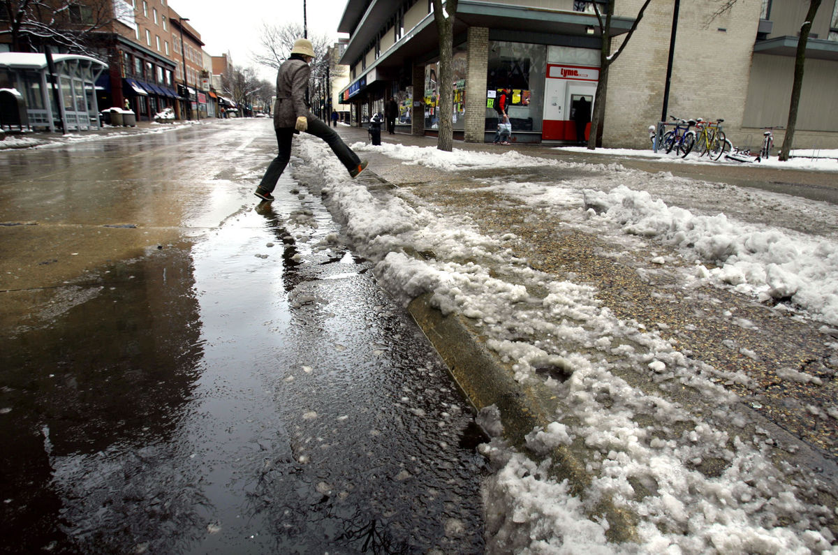
How unusual was the rapid intensification of Hurricane Patricia?

The recent extremely powerful Hurricane Patricia off the west coast of Mexico, the most intense hurricane ever measured in the Western Hemisphere, was noteworthy for a number of reasons.

Perhaps primarily, it was characterized by the incredible fact that its central minimum pressure decreased by 100 millibars in 24 hours from Oct. 22-23. Since the average sea-level pressure is just over 1,000 millibars, that means that 10 percent of the atmospheric column over the center of Patricia was somehow evacuated in only one day.

This mass evacuation is accomplished by upward vertical motion of the air and subsequent exportation to locations far from the central core of the storm. The circumstances that promote these vertical motions and allow the exportation of the air that is lifted are complicated and difficult to anticipate in extreme cases like Patricia.

However, the very same upward vertical motion and exportation of air occurs in the center of mid-latitude storms such as the ones that bring us our winter snows or even the one that brought us a rainy Halloween. A typical rate of intensification for a robust snowstorm such as those we might receive in Madison during winter is 12 millibars of pressure fall per day — more than eight times less dramatic than that which characterized Patricia.

Such sudden intensifications of tropical cyclones can still, as they did with Patricia, surprise forecasters. It is exceptionally rare, however, for any such surprises to contaminate forecasts of mid-latitude weather systems.

Category: Tropical, Weather Dangers

Comments Off on How unusual was the rapid intensification of Hurricane Patricia?

Will this mild November weather continue?

The Edmund Fitzgerald, a Great Lakes ore carrier, took on water and snapped in two during a storm on Nov. 10, 1975, on Lake Superior, plunging 556 to the lake bottom. Photo Credit: Burt Emanulle, Associated Press archives.

The Edmund Fitzgerald, a Great Lakes ore carrier, took on water and snapped in two during a storm on Nov. 10, 1975, on Lake Superior, plunging 556 to the lake bottom. Photo Credit: Burt Emanulle, Associated Press archives.

Not necessarily. Some warm Novembers had some severe extratropical cyclones, particularly around Veteran’s Day (formally known as Armistice Day).

Tuesday marks the 40th year since a winter storm blew across the Midwest, sending the freighter SS Edmund Fitzgerald to the bottom of Lake Superior with all 29 crew members. Gordon Lightfoot’s 1976 ballad “The Wreck of the Edmund Fitzgerald” helped make this incident the most famous disaster in Great Lakes shipping history.

The storm developed over the Oklahoma panhandle on the morning of Nov. 9, 1975, and headed for the Great Lakes, reaching Lake Superior by Nov. 10. The sustained winds of more that 40 knots resulted in waves larger than 20 feet.

This is also the 75th year after the Armistice Day storm of 1940, another memorable storm that ravaged the Upper Great Lakes region Nov. 11 and 12. This storm took down the Tacoma Narrows Bridge that spanned Puget Sound in the Pacific Northwest before heading to the Midwest. By the time this storm ended, it had killed more than 150 people, sunk at least three ships, stranded hundreds of train passengers, and isolated Midwestern towns with huge 20-foot snow drifts.

The “11-11-11” storm developed over southern Wyoming on the morning of Nov. 10, 1911 and traveled eastward reaching southwestern Iowa by the morning of the 11th. The storm’s center traveled northeastward across Wisconsin, reaching central Wisconsin by noon and Michigan’s Upper Peninsula by evening.

Category: Meteorology, Severe Weather, Weather Dangers

Comments Off on Will this mild November weather continue?

Why are cold snaps in autumn so short-lived?

Over the past weekend, southern Wisconsin experienced its first cold snap of the season with widespread morning lows in the upper 20s on Friday and Saturday mornings.

Often, cold snaps in autumn are short-lived, as this recent example was, affecting usually one or two nights at most.

There are a variety of reasons for this brevity. First, cold snaps at this time of year require a substantial southerly excursion of cold air from high latitude Canada to get us cold. Though the Arctic night creeps ever farther south each day after the autumnal equinox, its southerly progress is slow.

Consequently, cold air production is limited to the very highest latitudes well into November, which means that any cold air that makes it as far south as Madison is not well connected to a broader reservoir of cold air that would allow the cold to remain.

Second, there is little snow on the ground even in central Canada at this time of year and so the cold air that does migrate southward is modified (warmed) to a greater degree on that migration at this time of year than in the late fall and winter when snowcover is widespread.

Third, the lack of snow on the ground in Madison itself limits the longevity of cold snaps. This is even true in the wintertime. Overnight cooling over a snowfield can reinvigorate the chill of a cold snap and render it longer lasting as a result. So, if you were complaining about the cold this weekend, be glad we are still in October and much more likely to experience a quick rebound.

Category: Meteorology, Seasons

Comments Off on Why are cold snaps in autumn so short-lived?

What is a 100-year flood?

A flood occurs when water flows into a region faster than it can be stored in a lake or reservoir, absorbed into the soil, or removed by runoff into a drainage basin.

There are several conditions that can result in flooding: a long-lasting rainfall over a watershed, intense thunderstorms, or rainfall that causes rapid snow melt.

Because floods result under different circumstances and in different places, their impact varies. The term “100-year flood” allows us to place a particular flooding event in context with other floods.

It is wrong to think that a 100-year flood happens only once every 100 years. The phrase “100-year flood” describes the estimated probability of a flood event happening in any given year. A 100-year event has a 1 percent chance — or 1-in-a-100 chance — of occurring in any given year. While not likely, two 100-year flooding events can occur within a month of each other.

Scientists collect data on how frequently different sizes of floods occur and the time between these floods. They use this data to calculate the probability that a flood of a particular size will be equaled or exceeded during any year.

The term “100-year flood” is a statistical designation of an unlikely event. Statistically, a 100-year flood has approximately a 63 percent chance of occurring in any 100-year period, not a 100 percent chance of occurring.

Extreme and unlikely values are important for assessing the risk of unusual events. In the 1960s, the federal government decided to use the statistics of the 100-year event as the basis for the National Flood Insurance Program. These data continue to be used in determining flood insurance rates.

Category: Climate, Meteorology, Severe Weather

Comments Off on What is a 100-year flood?

Is hurricane forecasting improving?

Hurricane Joaquin taken at night by Astronaut Scott Kelly from the International Space Station on 2 Oct 2015.

Hurricane Joaquin taken at night by Astronaut Scott Kelly from the International Space Station on 2 Oct 2015.

The improvement in hurricane track is due to a number of factors. We now have better and more satellite observations, new observations from drones carrying weather instruments, and more aircraft with better instruments observing hurricanes.

Super computers that are faster improve forecast models by allowing more energy and dynamic processes to be incorporated more explicitly into the forecast. Due to improved observations, we can include better descriptions of the initial state of the atmosphere into the models, which leads to more accurate predictions of a storm’s behavior.

Forecasting the intensity of a hurricane hasn’t improved much in the last two decades, so work remains to be done in that area. This lack of improvement is likely a result of our lack of understanding of the physics that control these massive weather systems.

Hurricanes are complex, large and powerful, which makes them difficult to study. While we still lack the ability to accurately forecast hurricane intensity, our understanding of how hurricanes evolve, how they interact with dust outbreaks from Africa, and how a new eye begins to develop around the old eye of a hurricane, has grown substantially.

Category: Meteorology, Severe Weather, Tropical

Comments Off on Is hurricane forecasting improving?