Santa Ana winds are dry, warm, and gusty winds that blow from the interior of southern California toward the coast and offshore. They are a type of downslope wind, which is a wind directed down a slope produced by processes larger in scale than the slope.
Santa Ana winds can occur when the pressure gradient caused by a high-pressure region over the Rockies, in combination with friction, forces air from the mountainous West down the San Gabriel Mountains in southern California.
Atmospheric pressure always increases as one gets closer to Earth’s surface. An adiabatic process is one in which no heat energy is gained or lost by the system in question – in this case, a descending parcel of air. So, as an air parcel descends, it is compressed, which results in an adiabatic warming. The parcel warms at a rate of 10° C per kilometer, or about 29°F per mile of descent. This adiabatic warming also results in a lower relative humidity.
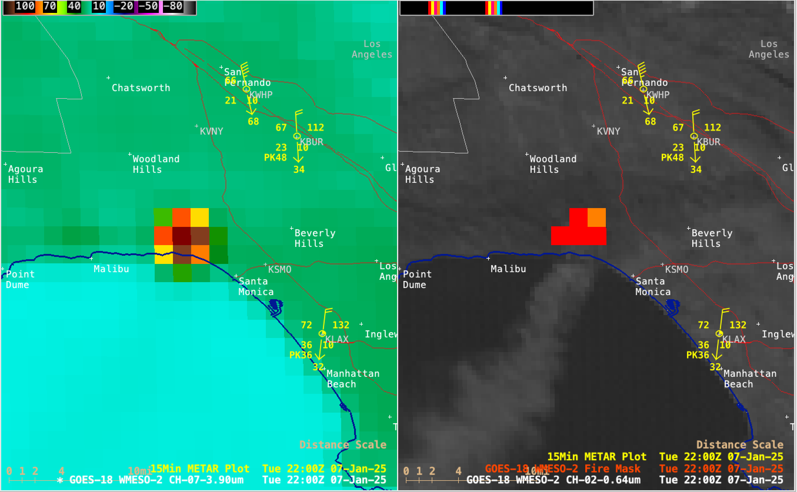
Santa Ana winds cause the temperature to increase and the relative humidity to plummet because of adiabatic warming. The wind speed also increases as the air squeezes through mountain passes and canyons, like a slow-moving river that suddenly narrows and turns into rapids. The strong winds become warmer as they descend as well as drier in terms of relative humidity. Santa Ana winds can turn large geographic areas into bone-dry tinderboxes. As in recent news, infernos from wind–related fires can rage throughout the affected area.
There are other types of downslope winds around the world that similarly bring hot, dry conditions to regions downwind of mountains and deserts. Some of these are the berg wind of South Africa, the leveche of Spain, and the sirocco of the Mediterranean Sea.
Steve Ackerman and Jonathan Martin, professors in the UW-Madison department of atmospheric and oceanic sciences, are guests on WHA radio (970 AM) at noon the last Monday of each month. Send them your questions at stevea@ssec.wisc.edu or jemarti1@wisc.edu.