The sea ice cover in the Arctic Ocean is one of the key components of our climate system.
The brightness of the sea ice reflects more solar energy to space than open water. Global warming is amplified in the Arctic as the ice cover decreases. This is referred to as the ice-albedo feedback.
As the polar regions warm, the amount of sea ice decreases, which allows more solar energy to be absorbed by the Arctic Ocean, which increases the warming, leading to more loss of sea ice. In the winter, the sun is below the Arctic Circle and so the sea ice can grow back.
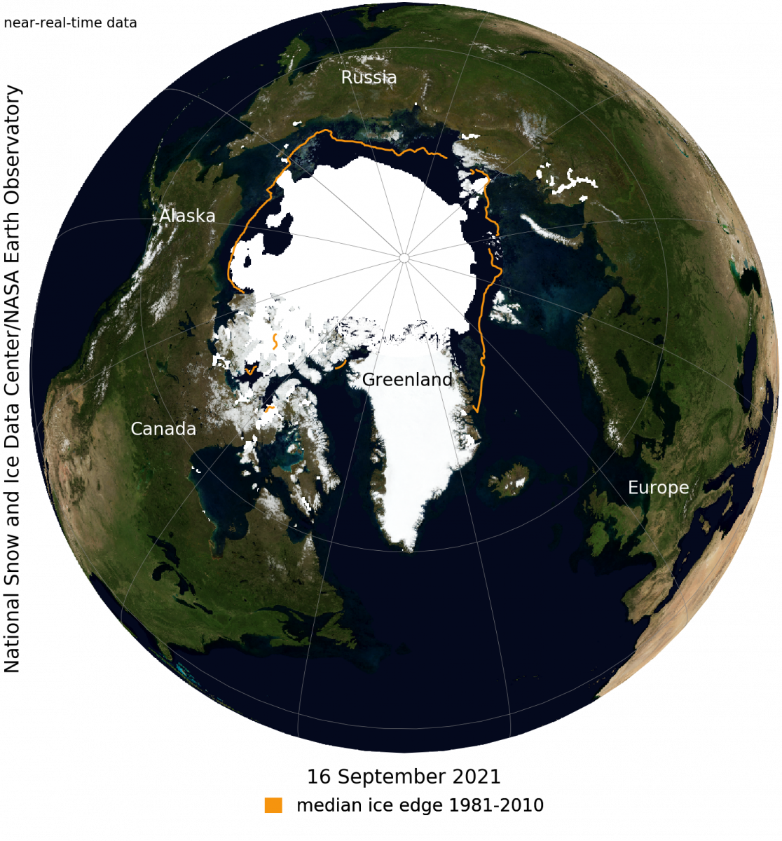
Observing sea ice coverage from satellites started in 1978. Those satellite-based observations have measured rapid changes in ice coverage, and that coverage has been declining. The overall, downward trend in the minimum extent from 1979 to 2021 is 13% per decade relative to the 1981 to 2010 average. The loss of sea ice is about 31,100 square miles per year, equivalent to losing the size of the state of South Carolina.
The Arctic Sea ice coverage typically reaches its smallest amount in mid-September. This is in response to the setting sun and falling temperatures. Then, the ice extent begins to increase and does throughout the winter. This year, based on satellite observations, the minimum occurred on Sept. 16 of 1.82 million square miles. The 2021 minimum is the 12th lowest in the satellite record. The last 15 years are the lowest 15 sea ice extents in the satellite record.
Multiyear ice is sea ice that exists for more than one year. Multiyear ice extent is one of the lowest on record.
Steve Ackerman and Jonathan Martin, professors in the UW-Madison department of atmospheric and oceanic sciences, are guests on WHA radio (970 AM) at 11:45 a.m. the last Monday of each month. Send them your questions at stevea@ssec.wisc.edu or jemarti1@wisc.edu.