What caused the snow showers of last week?

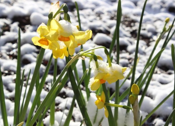
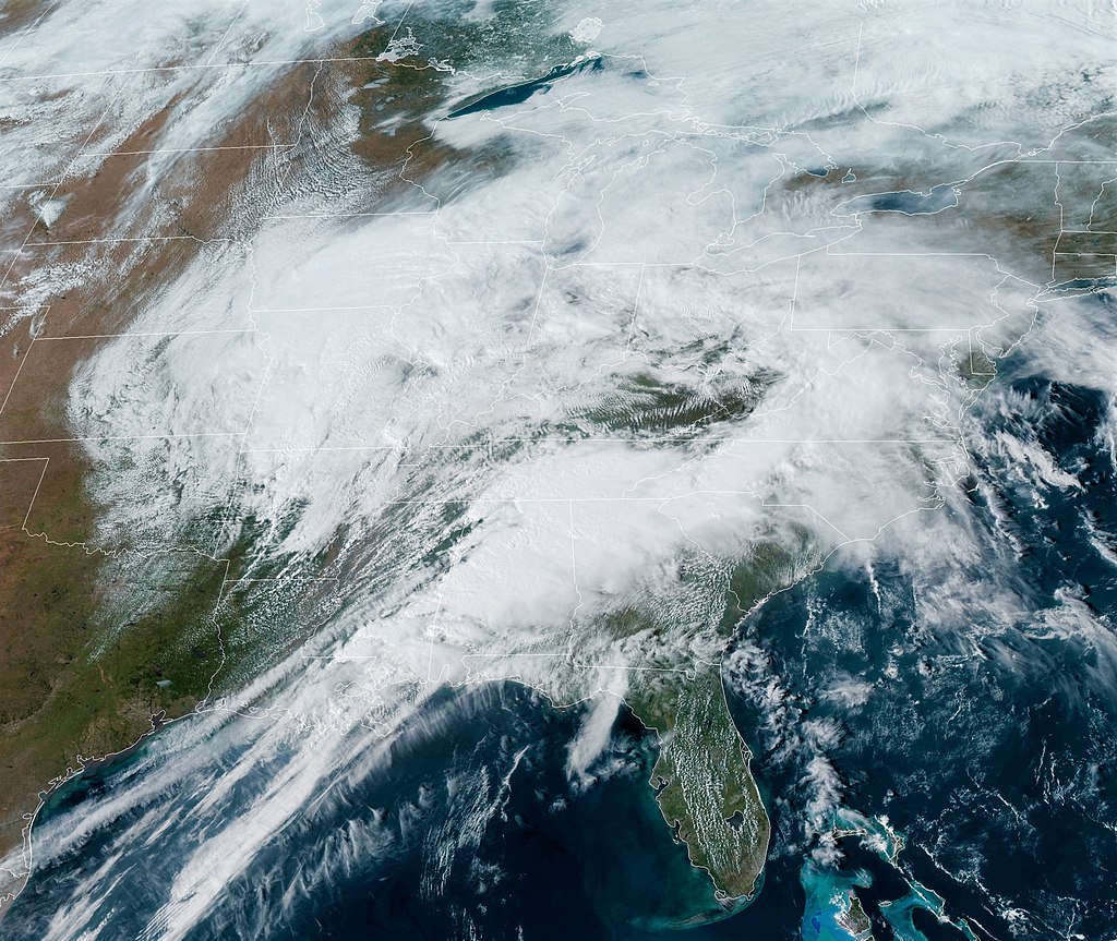
Last week’s snow showers garnered their fair share of attention.

The showers were intermittent, a snowy period often followed by a break in the clouds through which an interval of sunshine prevailed. On both days this showery activity ended near or just before sundown.

Satellite image displaying cloud-free and cloudy skies over Wisconsin on April 21 with glaciating cloud tops in green where snow showers developed.

The conditions that foster such behavior are interesting but not all that uncommon. The way in which the temperature of the air varies with increasing height above the ground determines the atmospheric stability. It turns out that when the difference between the surface temperature and the temperature some distance above the ground is large, the atmosphere is very susceptible to the development of showers.

Our showery days last week were characterized by air temperatures at about 3 miles above the ground that were near minus 35 degrees Celsius, while the surface temperature was about 5 degrees Celsius. That 40-degree temperature difference rendered the stratification quite unstable — especially to the ascent of saturated air.

Consequently, any initial movement upward of air bubbles near the ground resulted in those air bubbles rising freely to much higher elevation. As air rises it expands into the lower pressure environment and the expansion forces cooling which increases the relative humidity of the air. Eventually such freely rising bubbles of air produce clouds and precipitation.

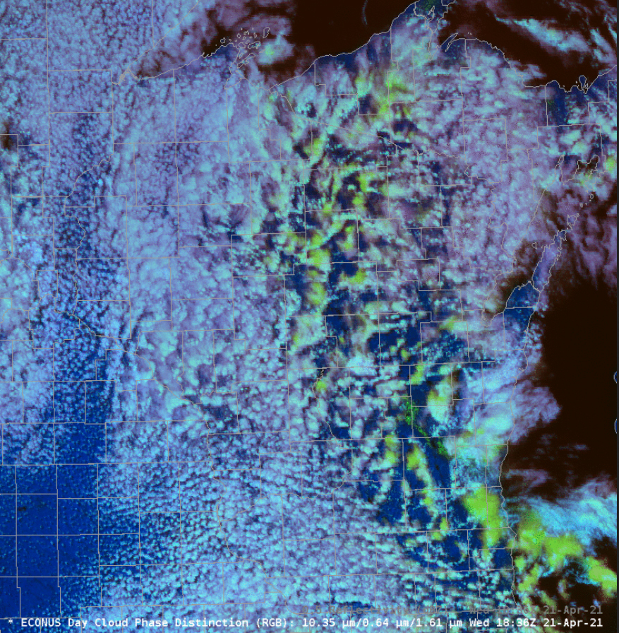
The scattered nature of the snow showers resulted from the fact that the regions of ascending air just described are surrounded by sinking air on their sides. The sinking forces the air to warm and dry out — thus producing the cloud-free regions between the showers. In such cloud-free regions, the surface temperature can rise in response to sunlight, which initiates another round of ascent and cloud production.

Steve Ackerman and Jonathan Martin, professors in the UW-Madison department of atmospheric and oceanic sciences, are guests on WHA radio (970 AM) at 11:45 a.m. the last Monday of each month. Send them your questions at stevea@ssec.wisc.edu or jemarti1@wisc.edu.

Category: Meteorology, Seasons

Comments Off on What caused the snow showers of last week?

Are April showers likely to be snow?

After a benevolent first week of April, we have really been brought back to reality as temperatures in Madison have been increasingly chillier since the monthly high of 79 was recorded on April 6.

April 14 was particularly chilly, with the high only getting to 40 under persistent clouds. It could be worse, however. Last Friday it snowed over southern New England — with totals as high as 9 inches in southern New Hampshire and widely greater than 2 inches in the northern suburbs of Boston.

Madisonians are not strangers to April snow, as it has struck us quite substantially in the past two Aprils — on the 12th through 14th last year and on the 10th and 27th in 2019.

Spring flowers struggling in Wisconsin’s 2019 April snow.
Credit Momcrieff.

Unusual weather is also occurring right now just east of the Philippines, where Typhoon Surigae roared with sustained winds above 140 mph (Category 4) over the weekend. Such early season typhoons (or hurricanes) are not without precedent, but they are unusual. Luckily, the storm center remained offshore and limited the damage. This storm was accurately predicted nearly two weeks in advance — quite remarkable given the unusual nature of a mid-April typhoon.

Unlike the recent snowy weather in southern New England, the morning of April 19, 1775, at Lexington, Massachusetts, dawned clear with a modest west wind, rising pressure and a temperature of 45.7 at 6 a.m., according to professor John Winthrop, who lived in a house on the Lexington Green. Later that morning, the first shots of the American Revolution were fired, and the more substantial Battle of Concord ensued in the afternoon.

Winthrop, in a wonderfully understated entry, noted in his journal that the “Battle of Concord will put a stop to observing.”

Steve Ackerman and Jonathan Martin, professors in the UW-Madison department of atmospheric and oceanic sciences, are guests on WHA radio (970 AM) at 11:45 a.m. the last Monday of each month. Send them your questions at stevea@ssec.wisc.edu or jemarti1@wisc.edu.

Category: History, Meteorology, Seasons

Comments Off on Are April showers likely to be snow?

Does it rain only on Earth?

Raindrops on Earth are made of water. On Neptune, scientists suspect it rains pure carbon in the form of diamonds. (Photo credit: John Hart, State Journal Archives)

It does precipitate on other planets and moons in our solar system.

On Earth, when particles fall from clouds and reach the surface as precipitation, they do so primarily as rain, snow, freezing rain or sleet.

On the average, a raindrop is between 0.1 to 5 millimeters. Raindrops on Earth are made of water. Sometimes they can pick up pollen or dust suspended in the atmosphere as the rain falls towards the ground.

The rain on other planets has very different chemical compositions. On Venus, it rains sulfuric acid. On Mars it snows dry ice, which is carbon dioxide in a solid state. Saturn’s moon Titan rains methane and on Jupiter, it rains helium and mushy ammonia hailstones. On Neptune, scientists suspect it rains pure carbon in the form of diamonds.

A recent science study simulated the maximum size of liquid droplets that would fall as “rain” under the different planetary conditions. It is a fairly narrow size range, given the large variation in the gravity of the planets and moons involved. Raindrops that are too big break up into smaller ones, while raindrops that are too small evaporate before they hit the ground.

On Earth, the maximum raindrop size is about 7/16 of an inch, a similar size as on Saturn. The maximum raindrop size on Titan is about 1 and 3/16 inches, and on Jupiter the maximum size is about 9/32 of an inch.

While cartoonists typically draw raindrops in a teardrop or pear-shape, raindrops are not shaped in those forms. They are drawn as teardrops to give the image of falling through the atmosphere, which they do.

No matter the planet or moon, as raindrops fall they are flattened and shaped like a hamburger bun by the drag forces of the air they are falling through.

Steve Ackerman and Jonathan Martin, professors in the UW-Madison department of atmospheric and oceanic sciences, are guests on WHA radio (970 AM) at 11:45 a.m. the last Monday of each month. Send them your questions at stevea@ssec.wisc.edu or jemarti1@wisc.edu.

Category: Meteorology, Phenomena

Comments Off on Does it rain only on Earth?

What is a red flag warning?

A firefighter with the Cal Fire Mendocino Unit walks along a containment line as a wildfire advances July 30, 2018, in Lakeport, Calif. A Red Flag Warning is issued when conditions may lead to especially dangerous wildfire growth. (Photo credit: Marco Jose Sanchez, Associated Press)

The National Weather Service issues, and cancels, fire weather watches (FWW), and red flag warnings (RFW) in coordination with the Wisconsin Department of Natural Resources and the U.S. Forest Service.

The weather service will not issue official warnings until certain threshold values, called red flag criteria, are forecast to occur. Red flag criteria differ from state to state. They usually include relative humidity values of 20% or less, winds of 20 mph or higher, and dry fuel conditions. Red Flag Warnings are usually only issued during the spring and fall fire weather seasons.

A Fire Weather Watch is issued 24 to 48 hours before the onset of red flag criteria. A Red Flag Warning is issued when red flag criteria are already occurring or will occur within the next 24 hours. The weather conditions under a Red Flag Warning may lead to especially dangerous wildfire growth. The warning alerts fire managers on federal and state lands that conditions are highly unfavorable for prescribed burns. Outdoor burning bans may be proclaimed by local law and fire agencies based on Red Flag Warnings.

The weather service will deploy specially trained forecasters to locations where large wildfires are active. These incident meteorologists, or IMETs, provide on-site weather support, including weather monitoring and daily fire weather briefings, to the command staff, firefighters and other incident personnel. Other atmospheric conditions can determine the danger of fire spread. For example, if the atmosphere is unstable, vertical movement of air tends to increase fire activity.

Steve Ackerman and Jonathan Martin, professors in the UW-Madison department of atmospheric and oceanic sciences, are guests on WHA radio (970 AM) at 11:45 a.m. the last Monday of each month. Send them your questions at stevea@ssec.wisc.edu or jemarti1@wisc.edu.

Category: Meteorology, Severe Weather, Weather Dangers

Comments Off on What is a red flag warning?

How is tornado intensity determined?


GOES East satellite Image of the storm system responsible for the Tornado Outbreak on March 25, 2021 (Photo credit: NOAA/NESDIS/STAR)

A deadly tornado outbreak took place Wednesday through Friday in the southern United States.

Tornadoes are classified based on the damage the tornado does, which enables us to estimate the wind speed of its rotating winds.

All tornadoes are assigned a single number from the Enhanced Fujita scale, abbreviated EF, according to the most intense damage caused by the storm.

This scale is based on the research of Ted Fujita and uses a set of 28 damage indicators to such structures as as barns, schools and trees. The degree of damage to each one is used to determine the EF scale number of every tornado.

The breakdown, and example damage, of the Enhanced Fujita scale is:

EF0

  • (weak): 65 to 85 mph; peels surface off some roofs; some damage to gutters or siding; branches broken off trees.

EF1

  • (weak): 86 to 110 mph; roofs severely stripped; mobile homes overturned or badly damaged; loss of exterior doors.

EF2

  • (strong): 111 to 135 mph; roofs torn off well-constructed houses; foundations of frame homes shifted; mobile homes destroyed.

EF3

  • (strong): 136 to 165 mph; severe damage to large buildings such as shopping malls; trains overturned; trees debarked; heavy cars lifted off the ground and thrown.

EF4

  • (violent): 166 to 199 mph; well-constructed houses and whole frame houses leveled.

EF5

  • (violent): 200-230 mph; strong frame houses leveled and swept away; steel-reinforced concrete structures badly damaged.

We do not classify the strength of a tornado until experts assess the damage it did to the area.

No matter the classification, all tornadoes are dangerous. During last week’s tornado outbreak at least five fatalities have been confirmed due to an EF2 tornado with another death due to an EF4 tornado.

Steve Ackerman and Jonathan Martin, professors in the UW-Madison department of atmospheric and oceanic sciences, are guests on WHA radio (970 AM) at 11:45 a.m. the last Monday of each month. Send them your questions at stevea@ssec.wisc.edu or jemarti1@wisc.edu.

Category: Meteorology, Severe Weather, Weather Dangers

Comments Off on How is tornado intensity determined?