What is energy’s relationship with rain?

Many locations across the country (and the world) have been experiencing unusually heavy rainfalls this summer.
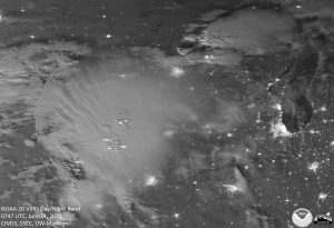
Overshooting tops, gravity waves, lightning and outflow boundaries in this 2021 moonlit satellite image conveys some of the energy in a single summer thunderstorm complex.

Though in Madison we have had a relatively benign month of August in terms of temperature and humidity, we have still managed to find ourselves 2.09 inches above normal for rainfall for the month prior to Sunday’s rain.

That monthly surplus is almost entirely accounted for by the extremely heavy rainfall on Wednesday night/Thursday morning when 1.86 inches of rain fell at the Dane County Regional Airport — our largest daily total since July 5 and second largest of the summer.

Rain is the liquid form of water, the only substance that occurs naturally in all three phases — solid, liquid and invisible gas — in the Earth’s atmosphere. The 1.86 inches of rain Wednesday/Thursday began as an equivalent amount of water in the invisible vapor (gas) phase before transformed into liquid.

It may come as no surprise that energy (600 calories) is required to transform 1 gram of liquid water into 1 gram of water vapor, the familiar process of evaporation. An exactly similar amount of energy is released into the environment when 1 gram of invisible water vapor condenses into a puddle of liquid water.

The particular amounts of energy needed to accomplish these changes of phase are known as latent heats — the latent heat of evaporation for the first one and the latent heat of condensation for the second. Since we know the depth of accumulated liquid precipitation involved in our recent heavy rain event, the area of Dane County, and the latent heat of condensation, we can calculate how much energy was released to the atmosphere in the production of that much rain.

Without providing the details of the calculation, we can report that the amount of energy involved in just that one rain event could power the entire Madison metro area for approximately 3.9 years. Clearly, there are huge amounts of energy involved.

Steve Ackerman and Jonathan Martin, professors in the UW-Madison department of atmospheric and oceanic sciences, are guests on WHA radio (970 AM) at 11:45 a.m. the last Monday of each month. Send them your questions at stevea@ssec.wisc.edu or jemarti1@wisc.edu.

Category: Meteorology, Severe Weather

Comments Off on What is energy’s relationship with rain?

How is this year’s Atlantic hurricane season measuring up?

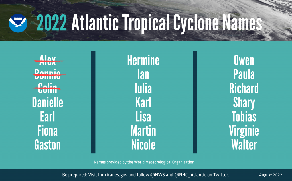
The Atlantic hurricane season is now more than two months old and has so far been fairly quiet with only three storms — all of them in the weakest category of tropical depression. This may well have been the case in the summer and fall of 1492 as well.

It is interesting to note that among the seemingly endless list of superstitions and fantastical falsehoods that surrounded voyages of exploration in the age of discovery — ranging from sea serpents of all kinds to boiling waters near the equator — there was no mention of hurricanes. This is obviously because no European had yet witnessed (and could not imagine) the frothing seas, with towering 100 foot waves, that these ferocious storms can create.

Columbus set sail on Aug. 3, 1492, from Palos de la Frontera and made the open ocean off the coast of Spain some days later. He reached the Bahamas in the first days of October, meaning that he sailed through the peak of the Atlantic hurricane season without incident. Twenty-seven years later, on Aug. 10, 1519, Ferdinand Magellan’s fleet of five ships left Seville on what would become the first circumnavigation of the globe. Magellan’s route also took him through the tropical Atlantic at the height of hurricane season and, again, without incident.

Thus, this year’s relatively inactive Atlantic hurricane season is not out of the ordinary and may end up being reminiscent of other inactive seasons from the past, in which one might argue the stakes were quite high.

Steve Ackerman and Jonathan Martin, professors in the UW-Madison department of atmospheric and oceanic sciences, are guests on WHA radio (970 AM) at 11:45 a.m. the last Monday of each month. Send them your questions at stevea@ssec.wisc.edu or jemarti1@wisc.edu.

Category: Seasons, Tropical

Comments Off on How is this year’s Atlantic hurricane season measuring up?

When does fog mostly occur in Madison?

Fog can occur anytime of the year, depending on the type of fog. In southern Wisconsin, fog is most frequent in the morning, between about 6 and 8 a.m.

Fog is a cloud in contact with the ground, and it forms as the dew point approaches the temperature of the air, increasing relative humidity. The air in contact with the ground can become very humid if it cools or when water from the surface evaporates into it. Either of these processes increases the relative humidity of the air. As the temperature of the air near the ground approaches the dew point, water vapor condenses on tiny particles suspended in the air to form a suspension of small water drops.

Fogs are named for the ways in which they form. Common types of fog in the Midwest include radiation fog, advection fog and evaporation fog.

Radiation fog in southern Wisconsin on August 11th as seen by satellite.

Radiation fogs form on clear, calm, long nights when the ground and the air in contact with it cool by radiation. As the temperature of the air drops, the relative humidity increases, and fog can form. Early-morning fogs are often radiation-type fogs.

When warm air is advected (blown horizontally) over a cold surface, the air near the ground cools because of energy exchanges with the surface. The relative humidity of the air increases with cooling and an advection fog may form.

Large unfrozen lakes are often shrouded in a fog in the fall and early winter. The lake water evaporates into the air above the lake surface. The air is cooled and moistened, causing the dew point to increase, forming an evaporation fog.

Each year about 700 fatalities occur in the United States because of traffic accidents during fog. A combination of high speed and low visibility is often to blame.

Steve Ackerman and Jonathan Martin, professors in the UW-Madison department of atmospheric and oceanic sciences, are guests on WHA radio (970 AM) at 11:45 a.m. the last Monday of each month. Send them your questions at stevea@ssec.wisc.edu or jemarti1@wisc.edu.

Category: Meteorology, Phenomena

Comments Off on When does fog mostly occur in Madison?

Can dust from Africa reach the United States?

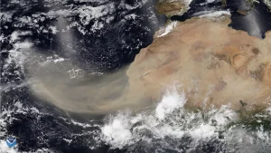
Image of dust blowing off the Sahara Desert from the NOAA-20 satellite, June 2020. (Image credit: NOAA/NESDIS)

Yes. Soil-derived aerosols, or dust, are abundant in our atmosphere. One source of dust is sandstorms over the Sahara. These storms whip small pieces of mineral dust from the desert into the atmosphere. Easterly winds then carry large plumes of Saharan dust away from the desert and over the Atlantic Ocean.

This weather system is referred to as a Saharan air layer, or SAL, and at times dust in the SAL has traveled to the Caribbean, Texas and Florida. Desert dust from the Sahara and Gobi deserts has been observed on the ice sheet of Greenland. Ice cores in Greenland provide a history of the dust deposition as it appears as layers in the ice.

This past July, satellites tracked a large plume of Saharan dust carried over the Atlantic Ocean. The incoming dust produces hazy-looking skies and causes red sunsets and sunrises. If rain should fall through the dust layer, the raindrops collect the soil particles. When the rain droplets hit objects on the ground, the water evaporates and leaves behind dry mud spots.

Dust plays a major role in Earth’s climate. The airborne dust particles absorb and reflect sunlight, thus reducing the amount of solar energy reaching the surface. Hurricane formation is very sensitive to several environmental factors including sea-surface temperature, vertical wind shear and even the SAL. The SAL is much drier than tropical air and can have a strong vertical wind shear. Both factors inhibit hurricane development. Dust can also promote or reduce cloud and storm formation, depending on other atmospheric conditions.

Dust from the Sahara impacts biological systems, as it is rich with iron and other minerals that plants and phytoplankton need. Dust transported out of the deserts is a natural fertilizer for ecosystems downwind. Iron and other nutrients in dust can lead to phytoplankton blooms as the dust settles into nutrient-limited waters.

Steve Ackerman and Jonathan Martin, professors in the UW-Madison department of atmospheric and oceanic sciences, are guests on WHA radio (970 AM) at 11:45 a.m. the last Monday of each month. Send them your questions at stevea@ssec.wisc.edu or jemarti1@wisc.edu.

Category: Climate, Meteorology, Seasons

Comments Off on Can dust from Africa reach the United States?

What are the wettest and driest days of Madison’s warm season?

All things considered, we have really had a rather benign summer in southern Wisconsin thus far this year. Through Friday of last week, July was averaging just over 1 degree warmer than normal, with the majority of the contribution to this slightly warm month coming in the overnight lows, which have been 1.5 degrees above normal thus far. In addition, except for the 1.23 inches of rain we received when the heat broke July 23-24, we would be just about normal for July.

Somehow we got thinking about some characteristics of warm-season (May through October) precipitation in Madison in the midst of this spell of fine summer weather. Dr. Ed Hopkins at the State Climatologist’s Office was on the ready for our question, which was: What are the wettest and driest calendar days during the warm season in Madison? By “wettest” we mean the calendar day on which the most total accumulated precipitation has been recorded in Madison’s 153-year climatological record — and the least for the “driest” day.

It turns out that July 21 is the wettest day of the calendar year. This is consistent with the prevalence of thunderstorms near the height of the summer in most years. The driest day is Oct. 9, which is a little more difficult to explain. Certainly at that time of year we are not usually subjected to locally heavy rains from thunderstorms, but it is not clear what might distinguish early October or the weeks preceding or following it with regard to precipitation.

By that time of the year the Northern Hemisphere is just beginning to adjust to the absence of sunlight at high latitudes, but that is probably not a factor for weeks to come. It does correlate with our anecdotal sense that the weather remains quite nice in this region into mid-October in most years.

Steve Ackerman and Jonathan Martin, professors in the UW-Madison department of atmospheric and oceanic sciences, are guests on WHA radio (970 AM) at 11:45 a.m. the last Monday of each month. Send them your questions at stevea@ssec.wisc.edu or jemarti1@wisc.edu.
Category: Climate, Seasons

Comments Off on What are the wettest and driest days of Madison’s warm season?