When does fog mostly occur in Madison?

Fog can occur anytime of the year, depending on the type of fog. In southern Wisconsin, fog is most frequent in the morning, between about 6 and 8 a.m.

Fog is a cloud in contact with the ground, and it forms as the dew point approaches the temperature of the air, increasing relative humidity. The air in contact with the ground can become very humid if it cools or when water from the surface evaporates into it. Either of these processes increases the relative humidity of the air. As the temperature of the air near the ground approaches the dew point, water vapor condenses on tiny particles suspended in the air to form a suspension of small water drops.

Fogs are named for the ways in which they form. Common types of fog in the Midwest include radiation fog, advection fog and evaporation fog.

Radiation fog in southern Wisconsin on August 11th as seen by satellite.

Radiation fogs form on clear, calm, long nights when the ground and the air in contact with it cool by radiation. As the temperature of the air drops, the relative humidity increases, and fog can form. Early-morning fogs are often radiation-type fogs.

When warm air is advected (blown horizontally) over a cold surface, the air near the ground cools because of energy exchanges with the surface. The relative humidity of the air increases with cooling and an advection fog may form.

Large unfrozen lakes are often shrouded in a fog in the fall and early winter. The lake water evaporates into the air above the lake surface. The air is cooled and moistened, causing the dew point to increase, forming an evaporation fog.

Each year about 700 fatalities occur in the United States because of traffic accidents during fog. A combination of high speed and low visibility is often to blame.

Steve Ackerman and Jonathan Martin, professors in the UW-Madison department of atmospheric and oceanic sciences, are guests on WHA radio (970 AM) at 11:45 a.m. the last Monday of each month. Send them your questions at stevea@ssec.wisc.edu or jemarti1@wisc.edu.

Category: Meteorology, Phenomena

Comments Off on When does fog mostly occur in Madison?

Can dust from Africa reach the United States?

Image of dust blowing off the Sahara Desert from the NOAA-20 satellite, June 2020. (Image credit: NOAA/NESDIS)

Yes. Soil-derived aerosols, or dust, are abundant in our atmosphere. One source of dust is sandstorms over the Sahara. These storms whip small pieces of mineral dust from the desert into the atmosphere. Easterly winds then carry large plumes of Saharan dust away from the desert and over the Atlantic Ocean.

This weather system is referred to as a Saharan air layer, or SAL, and at times dust in the SAL has traveled to the Caribbean, Texas and Florida. Desert dust from the Sahara and Gobi deserts has been observed on the ice sheet of Greenland. Ice cores in Greenland provide a history of the dust deposition as it appears as layers in the ice.

This past July, satellites tracked a large plume of Saharan dust carried over the Atlantic Ocean. The incoming dust produces hazy-looking skies and causes red sunsets and sunrises. If rain should fall through the dust layer, the raindrops collect the soil particles. When the rain droplets hit objects on the ground, the water evaporates and leaves behind dry mud spots.

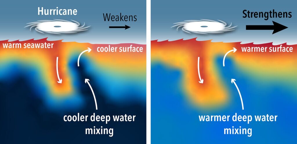
Dust plays a major role in Earth’s climate. The airborne dust particles absorb and reflect sunlight, thus reducing the amount of solar energy reaching the surface. Hurricane formation is very sensitive to several environmental factors including sea-surface temperature, vertical wind shear and even the SAL. The SAL is much drier than tropical air and can have a strong vertical wind shear. Both factors inhibit hurricane development. Dust can also promote or reduce cloud and storm formation, depending on other atmospheric conditions.

Dust from the Sahara impacts biological systems, as it is rich with iron and other minerals that plants and phytoplankton need. Dust transported out of the deserts is a natural fertilizer for ecosystems downwind. Iron and other nutrients in dust can lead to phytoplankton blooms as the dust settles into nutrient-limited waters.

Steve Ackerman and Jonathan Martin, professors in the UW-Madison department of atmospheric and oceanic sciences, are guests on WHA radio (970 AM) at 11:45 a.m. the last Monday of each month. Send them your questions at stevea@ssec.wisc.edu or jemarti1@wisc.edu.
Category: Climate, Meteorology, Seasons

Comments Off on Can dust from Africa reach the United States?

What are the wettest and driest days of Madison’s warm season?

All things considered, we have really had a rather benign summer in southern Wisconsin thus far this year. Through Friday of last week, July was averaging just over 1 degree warmer than normal, with the majority of the contribution to this slightly warm month coming in the overnight lows, which have been 1.5 degrees above normal thus far. In addition, except for the 1.23 inches of rain we received when the heat broke July 23-24, we would be just about normal for July.

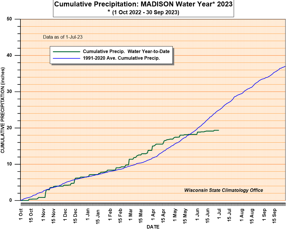
Somehow we got thinking about some characteristics of warm-season (May through October) precipitation in Madison in the midst of this spell of fine summer weather. Dr. Ed Hopkins at the State Climatologist’s Office was on the ready for our question, which was: What are the wettest and driest calendar days during the warm season in Madison? By “wettest” we mean the calendar day on which the most total accumulated precipitation has been recorded in Madison’s 153-year climatological record — and the least for the “driest” day.

It turns out that July 21 is the wettest day of the calendar year. This is consistent with the prevalence of thunderstorms near the height of the summer in most years. The driest day is Oct. 9, which is a little more difficult to explain. Certainly at that time of year we are not usually subjected to locally heavy rains from thunderstorms, but it is not clear what might distinguish early October or the weeks preceding or following it with regard to precipitation.

By that time of the year the Northern Hemisphere is just beginning to adjust to the absence of sunlight at high latitudes, but that is probably not a factor for weeks to come. It does correlate with our anecdotal sense that the weather remains quite nice in this region into mid-October in most years.

Steve Ackerman and Jonathan Martin, professors in the UW-Madison department of atmospheric and oceanic sciences, are guests on WHA radio (970 AM) at 11:45 a.m. the last Monday of each month. Send them your questions at stevea@ssec.wisc.edu or jemarti1@wisc.edu.
Category: Climate, Seasons

Comments Off on What are the wettest and driest days of Madison’s warm season?

Are heat waves increasing?

A heat wave is a period of abnormally and uncomfortably hot and usually humid weather.

The World Meteorological Organization is specific in its definition by stating that a heat wave is when the daily maximum temperature for more than five consecutive days exceeds the average maximum temperature by 9 degrees.

The National Oceanic and Atmospheric Administration, or NOAA, has analyzed the number of heat waves in the United State by decade, from 1961 to 2019, for 50 large metropolitan areas. Their analysis shows a steady increase in the average number of heat waves per year, with about two in the 1960s and six per year in the 2010s (2010-2019).

Of the 50 metropolitan areas studied, 46 experienced a statistically significant increase in heat wave frequency. The heat wave duration, defined as the length of each individual heat wave in days, has also been increasing — from an average length of three days per year in the 1960s to four days in the 2010s decade.

Heat waves are caused by very hot, stagnant air masses. Regions that suffer under intense hot spells are usually dominated by a surface high-pressure system with a mid-tropospheric ridge aloft. Dew points are also high, and to compound matters, wind speeds are often low. Clear or partly cloudy skies allow intense solar energy to further heat the ground and the air mass.

Heat waves are just one of the types of extreme weather becoming more frequent because of human caused climate change. So, it is a good time to consider the dangers of hot weather, as extreme heat kills more people in the U.S. than any other type of weather event. Each summer in the United States, approximately 175 to 200 deaths are attributable to heat waves. Most of these deaths occur in cities, particularly northern cities.

Steve Ackerman and Jonathan Martin, professors in the UW-Madison department of atmospheric and oceanic sciences, are guests on WHA radio (970 AM) at 11:45 a.m. the last Monday of each month. Send them your questions at stevea@ssec.wisc.edu or jemarti1@wisc.edu.

Category: Climate, Meteorology, Severe Weather

Comments Off on Are heat waves increasing?

What causes lightning?

Some people see the shape of Wisconsin in this looping lightning bolt that struck near Hager City on May 31, 2019. (Photo credit: Jerry Zimmer)

Charges form in a storm composed of ice crystals and liquid water drops. Winds inside the storm cause particles to rub against one another, causing electrons to be stripped off, making the particles either negatively or positively charged.

The charges get grouped in the cloud, often negatively charged near the bottom of the cloud and positively charged up high. This is an electric field, and because air is a good insulator, the electric fields become incredibly strong.

Eventually, the insulating capacity of the air is insufficient, and there is a rapid discharge of electricity that we know as lightning. The flash of lightning temporarily neutralizes the charged regions in the atmosphere, and the charges build up again.

The lightning causes a sudden increase in temperature in the path of a lightning bolt. Pressure change results due to the rapid expansion of the air in the path of a lightning bolt. The rapidly expanding air creates a sound wave that we hear as thunder.

Lightning can travel from cloud to cloud, within the same cloud, or between the cloud and ground. In-cloud lightning discharges are more common than cloud-to-ground discharges and are not as hazardous.

Wisconsin gets hit by lightning about 300,000 times a year, most of that during the spring and summer.

Lighting has different appearances. Staccato lightning is a cloud-to-ground lightning strike which is a short-duration stroke that often, but not always, appears as a single very bright flash and often has considerable branching.

Ribbon lightning occurs in thunderstorms with high cross winds and multiple strokes. The wind will blow each successive stroke slightly to one side of the previous stroke, causing a ribbon appearance.

Heat lightning is a common name for a lightning flash that appears to produce no discernible thunder because it occurs too far away for the thunder to be heard.

Steve Ackerman and Jonathan Martin, professors in the UW-Madison department of atmospheric and oceanic sciences, are guests on WHA radio (970 AM) at 11:45 a.m. the last Monday of each month. Send them your questions at stevea@ssec.wisc.edu or jemarti1@wisc.edu.

Category: Meteorology, Phenomena, Severe Weather

Comments Off on What causes lightning?