What’s behind November’s 70-degree days?

As the spectacular fall weather continued into November last week we saw temperatures soar into the 70s on the first three days of the month before plummeting back to more normal levels with the passage of a cold front on Saturday afternoon.

The three consecutive days — Nov. 1, 2, and 3 — represented only the fourth time in Madison’s weather history that at least three consecutive days in November registered high temperatures at or above 70 degrees. All of the other instances have occurred since 2008 — Nov. 3-5, 2008; Nov. 2-4, 2015, and the all-time longest such streak, which occurred Nov. 5-9, 2020. In addition, the latest-ever 70-degree day in a Madison November occurred on Nov. 17, 2016.

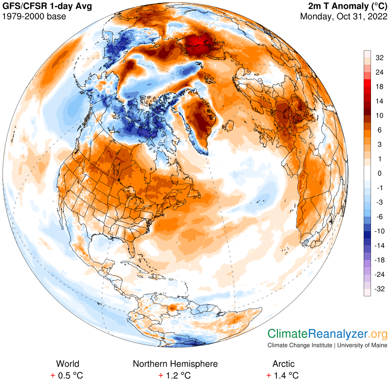
The fact that these several unusually late warm episodes have all occurred in the current century is no coincidence. Instead, it is yet another manifestation of the fact that the climate is warming.
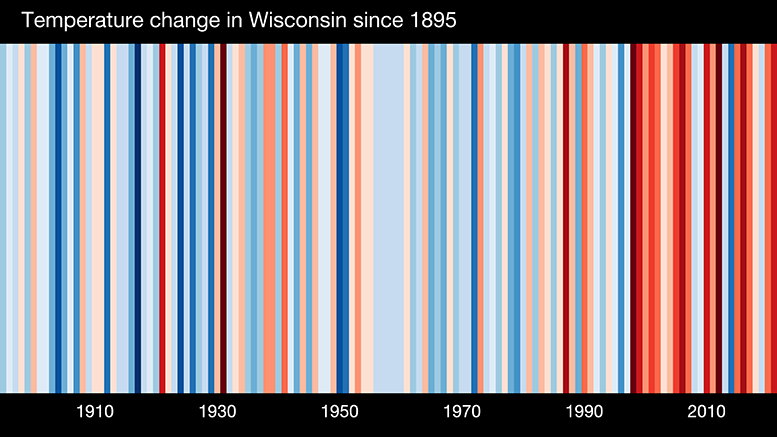
Annual temperatures for Wisconsin (warming stripes) from 1895-2021.
Credit: Ed Hawkins

There was a time not long ago when even the most interested citizen might struggle to find clear evidence of this warming based upon their own personal experience. This is no longer the case, as interesting episodes like this one attest. The influence of human beings in shaping this ongoing climate change is now indisputable, even as certain elected officials remain steadfastly determined to keep their eyes and ears closed about reality.

Steve Ackerman and Jonathan Martin, professors in the UW-Madison department of atmospheric and oceanic sciences, are guests on WHA radio (970 AM) at 11:45 a.m. the last Monday of each month. Send them your questions at stevea@ssec.wisc.edu or jemarti1@wisc.edu.

Category: Climate, Seasons

Comments Off on What’s behind November’s 70-degree days?

How unusual was the past weekend’s fantastic weather?

It is a fair bet that we would get near universal agreement that this October has been pretty spectacular here in southern Wisconsin.

Through the 29th, the average temperature has been exactly normal, and we have had only 11 days on which precipitation fell — twice it was snow — for a total that is 1.75 inches below normal.

Oct. 21 began a streak of four consecutive days with a high temperature of 72 degrees or higher, with the warmth soaring to 76 and 77 on the 21st and 22nd. Amazingly, this is just the third such streak that has ended as late in October in Madison’s 150-plus years of weather records.

Previous streaks ending this late in the month ran five days and occurred Oct. 23-27, 1989, and Oct. 22-26, 1963, during which we recorded our latest 80-degree day ever in town (the 23rd).

One other such streak that is worthy of note, though it does not qualify for this distinction, is the 21-consecutive days above 72 degrees that ended on Oct. 17, 1878 — meaning there was an October that had 17 straight days above 72.

The coming week will also have some really nice days, so our collective sense of the fine weather this fall will surely continue for most of this week.

Inevitably, however, winter will either creep in or rush in to replace these golden days of late fall. As that happens, try to find solace in the fact that we have just experienced a record-breaking streak of benign weather.

Steve Ackerman and Jonathan Martin, professors in the UW-Madison department of atmospheric and oceanic sciences, are guests on WHA radio (970 AM) at 11:45 a.m. the last Monday of each month. Send them your questions at stevea@ssec.wisc.edu or jemarti1@wisc.edu.

Category: History, Seasons

Comments Off on How unusual was the past weekend’s fantastic weather?

What makes the wind blow?

Southern Wisconsin has certainly experienced some windy days this past week.

Wind is defined as the horizontal movement of air from one place to another. Wind exists because of differences in air pressure.

Any movement requires a force, and in the case of wind, it is the horizontal pressure gradient that supplies the force. The gradient of an atmospheric variable measures the difference of that variable over a given distance. The pressure gradient is the difference in pressure over a certain distance.

Pushed by the pressure gradient forces, gases in our atmosphere move from areas of high pressure to low pressure. The larger the difference between the pressures over a given distance, the greater the pressure gradient force and the faster the air will move from the high to the low pressure.

The pressure, temperature and density of a gas are related to one another through a mathematical formula known as the ideal gas law. A change in one of these variables will cause a change in one or both of the others. Unequal heating of the atmosphere leads to pressure gradients which drive the winds.

Large plumes of blowing dust across the central Plains on Sunday October 23rd as seen by the NOAA-20 satellite, lofted by strong southwest winds.

A wind gust is a sudden, short burst of strong wind that moves faster than the current wind. As the wind blows, a number of things can interrupt air’s motion, such as trees, cars and buildings. Whenever air is obstructed in this way, friction comes into play and slows the wind. Once wind passes the object, it flows freely again, and its speed can increase abruptly. The speed of the wind, and the size and shape of the object that the wind is blowing against define how strong the gust will be.

Steve Ackerman and Jonathan Martin, professors in the UW-Madison department of atmospheric and oceanic sciences, are guests on WHA radio (970 AM) at 11:45 a.m. the last Monday of each month. Send them your questions at stevea@ssec.wisc.edu or jemarti1@wisc.edu.

Category: Meteorology, Phenomena

Comments Off on What makes the wind blow?

What is graupel?

Forms of frozen precipitation. L-R: hail, graupel, sleet, snow. (Photo credit: NOAA/NSSL)

Graupel is a type of frozen precipitation. Southern Wisconsin experienced this on Thursday afternoon.

Most clouds outside the tropical regions have temperatures that are below freezing somewhere in the cloud. These cold clouds are likely to have frozen cloud particles. They are also likely to include supercooled water drops, drops made of water that are below the freezing point.

Collisions between particles inside a cloud help create precipitation in cold clouds. When an ice crystal falls through a cloud it may collide with and collect supercooled water drops. This process of ice crystal growth by sweeping up supercooled water drops is called accretion, which can be thought of as a riming of the crystals. When ice crystals collide with supercooled drops, the drops freeze almost instantly. Accretion thus provides a mechanism for the particle to grow quickly, and when large enough fall out the bottom of the cloud.

An ice particle produced by the accretion process that has a size between 1 and 5 millimeters (0.04 to 0.2 inches) and no discernible crystal habit is called graupel (plural, graupeln). On collision and freezing, the supercooled water often traps air bubbles. Because of this trapped air, the density of a graupel is low, and it can easily be crushed, unlike a hailstone.

Hail is precipitation in the form of large balls or lumps of ice. Hail develops in the complex air motions inside a towering cumulonimbus cloud.

Aggregation is the process by which ice crystals collide and form a single larger ice particle. The probability that two crystals will stick together depends on the shape of the crystals and the temperature. A snowflake is an individual ice crystal or more likely an aggregate of ice crystals.

Steve Ackerman and Jonathan Martin, professors in the UW-Madison department of atmospheric and oceanic sciences, are guests on WHA radio (970 AM) at 11:45 a.m. the last Monday of each month. Send them your questions at stevea@ssec.wisc.edu or jemarti1@wisc.edu.

Category: Meteorology, Seasons

Comments Off on What is graupel?

Will we hit 80 degrees again this year?

We will not see 80 degrees again this year.

The last time Madison was officially 80 degrees or warmer was Sept. 21, the last official day of summer. In fact, 13 of the first 21 days of last month we were at least that warm — fairly remarkable.

The weather has turned abruptly since then, culminating with our first really cold air of the year from Thursday night into Saturday. A number of locations in the area had their first night below freezing during this stretch, and temperatures dropped to 12 degrees in a couple of towns in southwestern North Dakota.

The dramatic about-face got us thinking about that 80-degree mark and whether it is likely to appear again this year.

The earliest day on which Madison has ever recorded its last 80-degree day of the year was Sept. 2, 1977 (and 2020). The all-time latest 80-degree day in Madison’s history was on Oct. 23, 1963. The average last such day (since 1939) is Sept. 29.

Within the 83 seasons (not including this one) since 1939 there have been 17 times when the last 80-degree day occurred after today’s date, Oct. 10 — just over 20% of the time. Though that might inspire hope that it is not terribly unusual to get that warm after today’s date, this year it seems unlikely that we will see that kind of warmth again as at least the next 10 days seem certain to be cooler than that.

So, enjoy the brilliant sunshine, light winds and dry conditions that have set in over us these last couple of weeks — but consider the summer officially over.

Steve Ackerman and Jonathan Martin, professors in the UW-Madison department of atmospheric and oceanic sciences, are guests on WHA radio (970 AM) at 11:45 a.m. the last Monday of each month. Send them your questions at stevea@ssec.wisc.edu or jemarti1@wisc.edu.

Category: Climate, Meteorology, Seasons

Comments Off on Will we hit 80 degrees again this year?