We watched in stunned horror the suffering of our fellow citizens across parts of the South in the aftermath of the nearly back-to-back disasters wrought by hurricanes Helene and Milton.
Naturally the question of whether these storms were made more intense and impactful by the ongoing, slow background warming has been considered in discussions of these events.
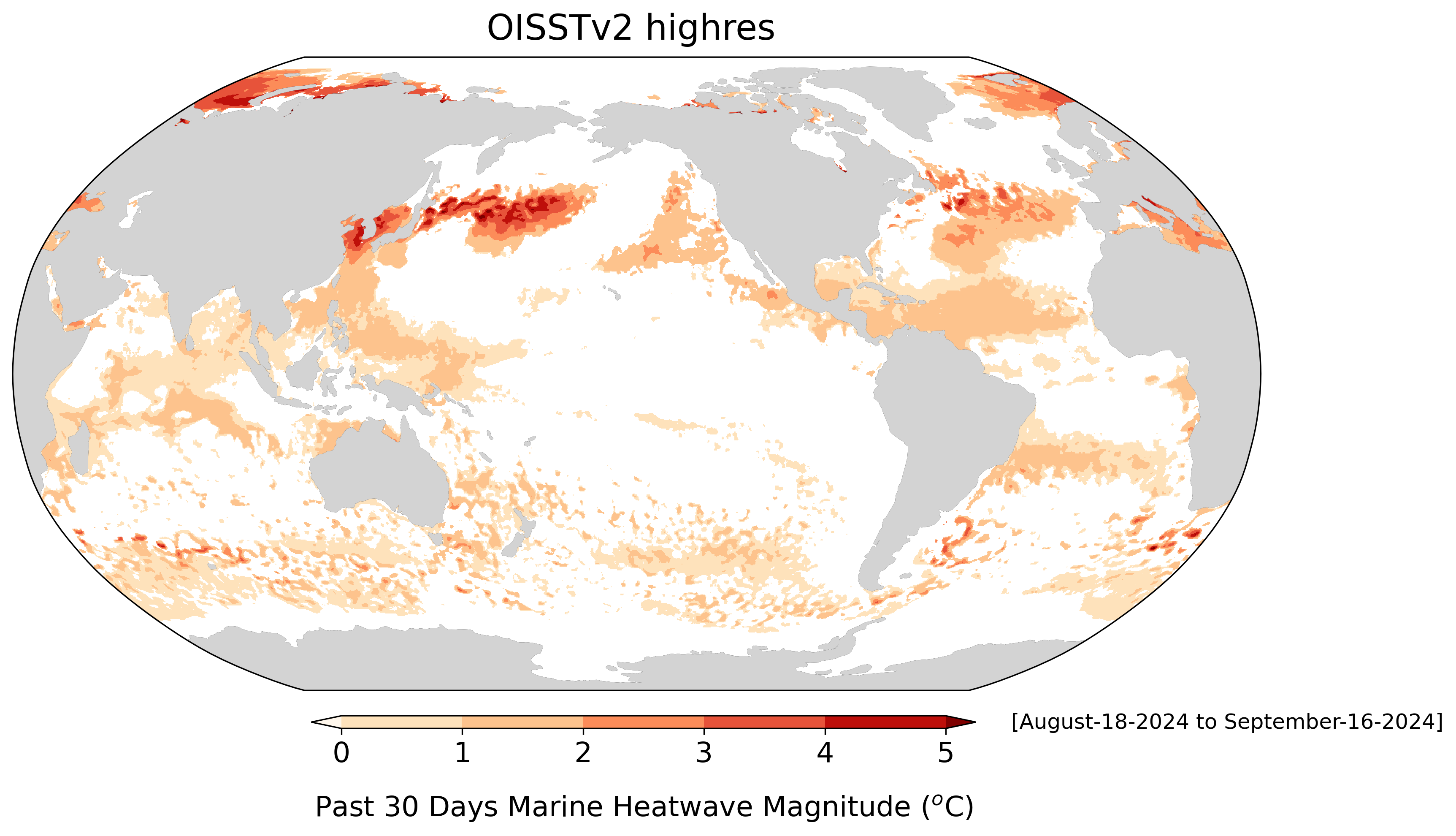
It is true that the Gulf of Mexico sea surface temperatures in the regions from which these storms came is as many as 4 degrees Fahrenheit warmer than normal this season. It is also true that the ocean heat content, a measure of how much heat is actually available in the ocean, well below the surface, has been increasing during the warming era. Both of these ingredients are potent fuel for tropical storm intensification.
So, from that perspective, it is reasonable to conclude that global warming has at least a plausible physical connection to the development of these monsters.

One of our major political parties has decided that it is best to ignore this possible connection and to carry on as if nothing of concern were happening. One particular elected public servant, U.S. Rep. Marjorie Taylor Greene, has even suggested that there is a nefarious conspiracy afoot wherein unspecified government officials are controlling the weather. Writing on X on Oct. 3, she proclaimed, “Yes, they can control the weather. It’s ridiculous for anyone to lie and say it can’t be done.”
Any expert, and certainly the two of us, can say with great certainty that it is not possible to control the weather. Even the huge investments in cloud seeding in the 1950s and 1960s, made in hopes of alleviating local drought, were eventually declared inconclusive — certainly not a triumph for weather control.
It might be better if the passion exhibited by Taylor Greene, along with other elected (and unelected) officials in her party, was directed toward continued funding for better understanding of the science underlying the weather and climate rather than asserting outrageous conspiracy theories and threatening to weaken our exceptional National Weather Service.
Steve Ackerman and Jonathan Martin, professors in the UW-Madison department of atmospheric and oceanic sciences, are guests on WHA radio (970 AM) at noon the last Monday of each month. Send them your questions at stevea@ssec.wisc.edu or jemarti1@wisc.edu.