Why is May 6 such a special day in weather science history?

Immediately after WW II, it became fashionable to imagine technologies that might allow human beings to control the weather.  In fact, one goal advanced by influential scientists was actually to explode nuclear bombs in the right locations and in the right quantity so as to alter the weather in favorable ways.  Such an enterprise would require accurate forecasts of the weather thought possible by using the brand new computer technology to make the millions of requisite calculations. 

NOAA historic weather computer circa 1965, used to process weather data for short and long-range forecasts, analyses, and research. (Photo credit: NOAA’s National Weather Service Collection)

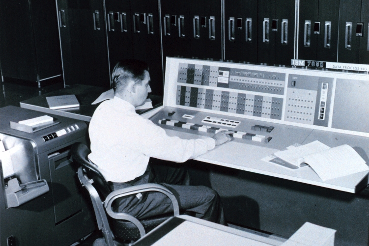
The drive to use computer models for weather forecasting was initiated at a secret meeting at the U.S. Weather Bureau headquarters in Washington D.C. on the rainy morning of January 6, 1946.  After a series of successes and setbacks that mostly discouraged the broad meteorological community, the first operational computer generated forecasts were issued on the afternoon of May 6, 1955. 

Thus, in less than 10 years the notion of computer-based forecasts went from dream to reality.  In the intervening 70 years the combination of increased theoretical understanding both of meteorology and computational science, increased observational capacity (a good deal of which stems from satellite data), and sheer hard work on the part of a legion of dedicated scientists has resulted in our current forecasting capability. 

The fact that our ubiquitous smart phones give everyone access to quite reasonable forecasts several days in advance is the end result of what might be considered the greatest scientific advance of the second half of the 20th century.  So, as you consult your phone for the forecast, remember that one of the first baby steps in the march toward the modern miracle of numerical weather prediction were taken just over 70 years ago.

Steve Ackerman and Jonathan Martin, professors in the UW-Madison department of atmospheric and oceanic sciences, are guests on WHA radio (970 AM) at noon the last Monday of each month. Send them your questions at stevea@ssec.wisc.edu or jemarti1@wisc.edu.

Category: History

Comments Off on Why is May 6 such a special day in weather science history?

When will we have our last spring frost?

The latest frost in spring is important to gardeners as we seek to protect our garden plants from freezing temperatures. For Madison, based on temperature observations between 1940 and 2024, the latest frost occurred on 10 June 1972 and the earliest final frost occurred on 7 April 1955. The last frost date varies from year to year as it is strongly dependent on current weather conditions. To best estimate the last frost is to use statistics over a given time period. The median date for the last frost in Madison is May 5.  Giving the median date of last frost means that there is still a 50% chance that a frost will occur after this date. 

This map of the United States shows the most common date range you can expect to see temperatures dip to 32°F or below for the last time. The map also reveals some interesting regional differences across the country. (Image credit; NOAA’s National Centers for Environmental Information)

An analysis of Madison’s last frost date from 1940 – 2024 shows a trend consistent with the scientific expectations of global warming, that the last frost date now occurs earlier in the spring. Our nighttime minimum temperatures have been getting warmer and that too is consistent with the last frost date moving earlier. 

In addition to following local forecasts, there are some observations you can make to aid in predicting the formation of frost in your yard.  If at sunset the temperature is close to freezing, then there is a better chance for the formation of frost overnight.  Clouds are good emitters of infrared energy so they reduce the energy losses at the ground during the night. If it is cloudy and will stay cloudy, then the likelihood of frost is reduced. Knowing the dewpoint is also important. A rule of thumb–if the dew point is above 45°F at sunset then you are probably OK. If below 40°F, you will probably see a frost if the other weather conditions are aligned.

Steve Ackerman and Jonathan Martin, professors in the UW-Madison department of atmospheric and oceanic sciences, are guests on WHA radio (970 AM) at noon the last Monday of each month. Send them your questions at stevea@ssec.wisc.edu or jemarti1@wisc.edu.

Category: Climate, Seasons

Comments Off on When will we have our last spring frost?

What causes tornados and do they have a lifecycle?

A tornado is a powerful column of winds that rotate around a center of low pressure. The winds inside a tornado spiral inward and upward, often exceeding speeds of 300 mph. We don’t know if a particular storm will produce a tornado but we do know the necessary conditions needed for tornado formation.

The required conditions for a thunderstorm to produce a tornado are warm humid air near the surface with cold dry air above. These conditions make the atmosphere very unstable, in the sense that once air near the ground is forced upward, it moves upward quickly and forms a storm. Severe thunderstorm conditions also include a layer of hot dry air between the warm humid air near the ground and the cool dry air aloft. This hot layer acts as a lid that allows the sun to further heat the warm humid air, making the atmosphere even more unstable.

An idealized cross section of a mature supercell with some major features and wind flow patterns. Except for the rotating updraft (the definition of a supercell) not all of these features are necessarily present or visible in every storm. (Image credit: NOAA’s NWS Stormspotter Guide)

To form a tornado, the host thunderstorm also must rotate. This happens in a storm when wind at the ground is moving in a different direction and speed than the air above. The change in wind speed and direction with height is known as wind shear. This wind shear develops the rotation in the thunderstorm needed for tornado formation.

Once formed, tornadoes exhibit a typical four-stage life cycle. The first stage is the organizing stage, during which a funnel cloud picks up debris as it reaches the surface and widens. The mature stage follows when the tornado is often at its peak intensity and width. The tornado reaches the shrinking stage when its funnel narrows, and it ends with a decaying or “rope” stage. At this point, the funnel thins out to a very narrow, ropelike column, after which it eventually dissipates.

Steve Ackerman and Jonathan Martin, professors in the UW-Madison department of atmospheric and oceanic sciences, are guests on WHA radio (970 AM) at noon the last Monday of each month. Send them your questions at stevea@ssec.wisc.edu or jemarti1@wisc.edu.

Category: Meteorology, Phenomena, Severe Weather

Comments Off on What causes tornados and do they have a lifecycle?

Should we stop climate research?

Scientific evidence for slow, ongoing, systematic warming of Earth’s atmosphere is unequivocal. This conclusion comes from evidence-based science and a physical understanding of that evidence. Regular scientific assessments of global and regional climate began in the 1970s. These assessments, along with a physical understanding of the atmosphere, show that the impact of human activities on this warming has evolved from theory to established fact.  This is not a radical political statement; it is a firm conclusion based on the analysis of carefully considered observations. 

Yearly surface temperature from 1880–2024 compared to the 20th-century average (1901-2000). Blue bars indicate cooler-than-average years; red bars show warmer-than-average years. Image credit: NOAA Climate.gov graph, based on data from the National Centers for Environmental Information)

Burning fossil fuels generates greenhouse gases, which are transparent to solar radiation but absorb large amounts of terrestrial infrared radiation that results in warming the atmosphere. The planet’s average surface temperature has risen about 2 degrees Fahrenheit since the late 1800s.  Most of that warming has occurred in the past 40 years.

The warming trends are manifest in a number of ways.  For example, the agricultural growing season can be defined as the time between a region’s last frost and the first frost. The growing season in the contiguous 48 states has increased by more than two weeks since the beginning of the 20th century. The Plant Hardiness Zone Map (PHZM) was developed by the U.S. Department of Agriculture and first published in 1960. The PHZM was recently revised and reflects the observed changes in our climate. In Wisconsin, some zones have shifted north and the cold zone (3b) no longer resides in Wisconsin.  As noted in this column before, the areal extent of air colder than 23 degrees F one mile above the ground during Northern Hemisphere winter has also systematically decreased since at least 1948.

Global warming is occurring, and its impacts are increasingly difficult to overlook.  At such a juncture, the least prudent move would be to halt research on the problem.  And yet, because too many of them want to pretend there is no problem, our leaders in Washington D.C. are conspiring to do just that.  History is an uncompromising judge and will not remember these leaders well.

Steve Ackerman and Jonathan Martin, professors in the UW-Madison department of atmospheric and oceanic sciences, are guests on WHA radio (970 AM) at noon the last Monday of each month. Send them your questions at stevea@ssec.wisc.edu or jemarti1@wisc.edu.

Category: Climate, History

Comments Off on Should we stop climate research?

How do satellites help forecast the weather?

Satellite data help forecast the weather in two ways: expert forecasters interpret the satellite images and numerical weather-prediction models assimilate the data they collect. Image analysis plays an important role in short-term forecasts, those that predict the weather 1 to 3 hours into the future, while numerical weather predictions are more useful in 12-hour to 3-day forecasts.

A 16-panel view of the continental US from the GOES-18 satellite. Each panel shows a different band on the ABI instrument. (Image credit: CIMSS)

While weather forecasters routinely analyze current satellite observations, most data never reach forecasters’ eyes. Most satellite observations are assimilated into numerical weather-prediction models. Today’s weather forecast models rely on satellite data to make accurate weather predictions. These satellite observations include the vertical distribution of temperature and humidity, cloud distributions, land and sea surface temperatures, location of volcanic ash, fires, and wind speeds and directions.

Professor Verne Suomi (1916-1995) is internationally regarded as the Father of Satellite Meteorology. In the early 1960’s he advocated for the benefits that would be gained by observing a single weather phenomenon from space at frequent time intervals. Suomi and Robert Parent, a professor in electrical engineering, started the Space Science and Engineering Center (SSEC), where they invented the Spin Scan Radiometer. Suomi and Parent saw their spin-scan camera launched in 1966 on NASA’s new geostationary Advanced Technology Satellite (ATS-1). These concepts enabled the tracking of movement and development of weather systems, and thus revolutionized satellite meteorology. For many years the spin-scan radiometer was the instrument on the NOAA’s geostationary weather satellites that generated the time sequences of cloud images seen on television weather shows and now the internet. The Space Science and Engineering Center at the University of Wisconsin-Madison, is regarded as the Birthplace of weather satellites.

We have much to learn about the vagaries of weather. One of the most important means of doing so involves the fleet of spacecraft dedicated to the task of watching our atmosphere. Future satellite systems will continue to improve our ability to monitor and forecast storms, and Wisconsin will continue to play a key role in the development of weather satellites and their use in weather forecasting.

Steve Ackerman and Jonathan Martin, professors in the UW-Madison department of atmospheric and oceanic sciences, are guests on WHA radio (970 AM) at noon the last Monday of each month. Send them your questions at stevea@ssec.wisc.edu or jemarti1@wisc.edu.

Category: History, Meteorology

Comments Off on How do satellites help forecast the weather?