
Unmanned aerial vehicles, or UAVs, have been used to make weather observations for half a century. Over the past decade there has been a wider application of drones in meteorology due in part to technological developments.
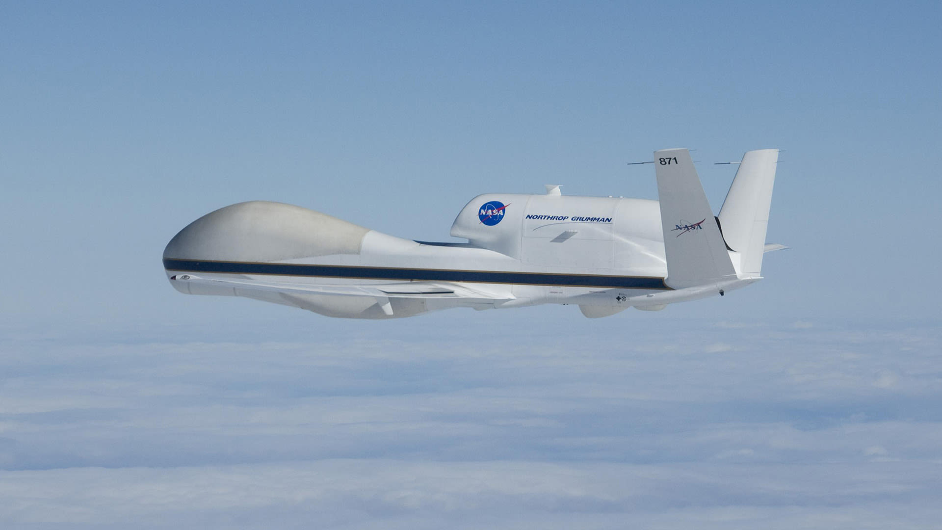
Drones can provide critical research observations of weather systems. For about a decade, NOAA has partnered with NASA to fly the Global Hawk high-altitude unmanned aircraft to observe and study how hurricanes form and intensify. High-resolution photographs from low-flying drones are used to understand and document wind and flood damage associated with severe weather. They also help to better assess storm intensity based on the damage.
Routine integration of weather drones into weather forecasting would provide more precise monitoring of localized atmospheric conditions. However, restrictions on flight paths are one barrier to using drones in operational weather forecasting. Federal regulations prohibit drones from being deployed beyond visual line of sight. In addition, drones do not perform well in poor weather conditions. Swarm drone intelligence is also needed to coordinate multiple drones in sensing the boundary layer.
Drones with meteorological instruments, referred to as meteodrones, provide important observations of the lower atmosphere where there is a dearth of data, despite the importance of this boundary layer in weather forecasting. Drone systems are being developed to provide this data, as sustained observations of the boundary layer would improve local weather forecasting.
This spring, the World Meteorological Organization is planning a seven-month worldwide campaign to assess drones’ capability to improve weather forecasting. About 40 drone teams will coordinate and launch their drones to collect atmospheric observations in the U.S., Europe and Asia. The participants will share their data for analysis and study the impact of drone observations, along with established radiosondes and weather balloon data, on weather forecasting.
Steve Ackerman and Jonathan Martin, professors in the UW-Madison department of atmospheric and oceanic sciences, are guests on WHA radio (970 AM) at 11:45 a.m. the last Monday of each month. Send them your questions at stevea@ssec.wisc.edu or jemarti1@wisc.edu.