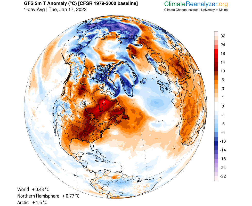
Here we are halfway through the month of January, and it has been remarkably mild for those of us in southern Wisconsin.
Through Saturday, January has been 10.3 degrees above normal in Madison and 10.6 degrees above normal in Milwaukee. In fact, since Christmas Day, the temperature in Madison has averaged just shy of 9 degrees (8.93 degrees) above normal in what is usually one of the colder stretches of the year.
Though weather has been savage in many other locations around our country, with floods in California and deadly tornadoes in the South, we have experienced very little wintry weather. Madison has received just 1.1 inch of snow so far — more than 4 inches below normal, with the measly 0.4 inches on Jan. 4 leading the way in this unusually dry month.
Temperatures around the Northern Hemisphere have been unusually warm as well. The areal extent of air colder than minus 5 degrees Celsius (23 degrees Fahrenheit) about 1 mile above the surface is one way to measure this. This year’s value — from Dec. 26 to Jan. 14 — is the record smallest value in the 75 years of data availability, and by quite a wide margin.
Thus, we have all just lived through the mildest three-week stretch at the beginning of Northern Hemisphere winter that has ever been recorded. And, though there is no guarantee this will continue through the rest of the winter, the current seven-day forecast does suggest that unusually warm temperatures are likely to persist across much of North America in the coming week.
Steve Ackerman and Jonathan Martin, professors in the UW-Madison department of atmospheric and oceanic sciences, are guests on WHA radio (970 AM) at 11:45 a.m. the last Monday of each month. Send them your questions at stevea@ssec.wisc.edu or jemarti1@wisc.edu.


