
On August 18th 1969, Hurricane Camille, the second-worst hurricane in U.S. history, made landfall on the Mississippi coast with 190-mph winds at Bay St. Louis. Camille claimed 256 lives.
Though the official Atlantic basin hurricane season runs from June 1 to Nov. 30, the peak of the season historically runs from mid-August to mid-October. During that subset of the entire season, well more than 70% of all storms in the last 100 years have occurred.
The actual peak of the season is on or about Sept. 12.
This year’s season has gotten off to a robust start with 11 tropical storms and two hurricanes so far.
A number of research and forecasting groups with years of experience in the practice of forecasting hurricane activity have recently updated their forecasts for this season.
On Aug. 5, a group at Colorado State University, led by Dr. Phil Klotzbach, revised its forecast in calling for 24 named storms, 10 hurricanes, and four major hurricanes. They based this update on the persistence of low vertical wind shear, low surface pressures, and much warmer than average sea-surface temperatures in the tropical Atlantic since July.
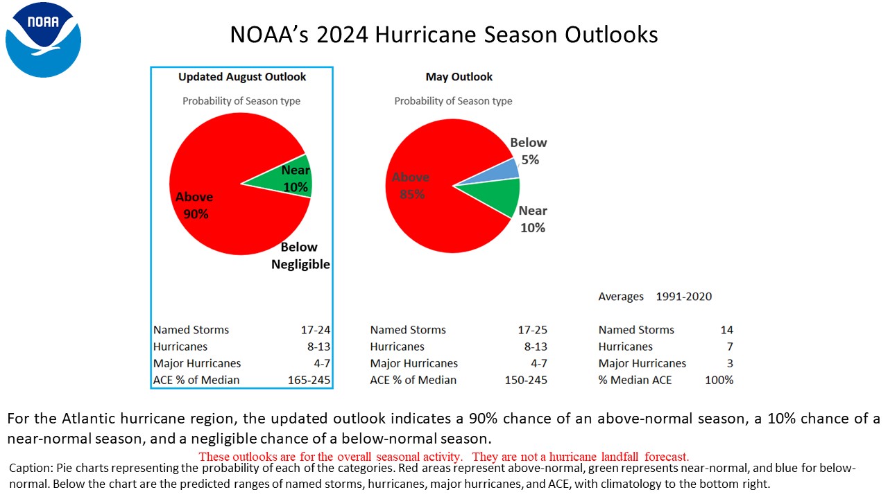
The next day, the National Oceanic and Atmospheric Administration (NOAA) released its revised seasonal forecast calling for an “extremely active” season with 19 to 25 named storms, seven to 11 hurricanes and three to six major hurricanes.
NOAA has only rarely forecast such an active season. Thus, as we enter the heart of the hurricane season, conditions appear to be ripe for an unusually active and potentially destructive next two months.