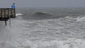
An onlooker checks out the heavy surf at the Avalon Fishing Pier in Kill Devil Hills, N.C., as Hurricane Florence approaches the east coast Sept. 13. This year’s official hurricane season runs from June 1 through Nov. 30. (Photo credit: Gerry Broome, Associated Press)
A hurricane is a tropical storm over the Atlantic Ocean basin. The official hurricane season runs from June 1 through Nov. 30.
But that doesn’t mean all hurricanes have to occur during that time period. Indeed, we have already had a hurricane on May 20. That storm is named Andrea. Hurricanes are given names to improve communication between forecasters and the public regarding forecasts.
The National Oceanic and Atmospheric Administration has been making seasonal hurricane forecasts for about the last decade. Their Atlantic Hurricane Season Outlook for this year indicates there is a 70% likelihood of having nine to 15 named storms of which four to eight could become hurricanes, including two to four major hurricanes.
A tropical storm is named if the wind speeds are 39 mph or higher. A hurricane has winds of 74 mph or higher, and a major hurricane has winds of 111 mph or higher. On average, the Atlantic Ocean sees 12 named storms, six hurricanes and three major hurricanes.
So, if the forecast holds up, we are in for a near-normal hurricane season. NOAA’s Climate Prediction Center will update the seasonal outlook in August just prior to the historical peak of the season.
The forecast is based on current and expected conditions. First, an active season would be predicted if the sea surface temperatures are warmer than normal. Warmer temperatures increase evaporation off the sea surface and that provides the energy for the storm.
The forecast is also a function of the El Niño conditions in the Pacific Ocean. We are currently in weak El Niño conditions and, on average, El Niño years are low-hurricane years.
Perhaps surprisingly, the atmospheric pressure pattern over the Arctic also plays a role in the forecast: high pressure means a weaker jet stream, which favors hurricane development.

