When was the use of computers for weather prediction first considered?

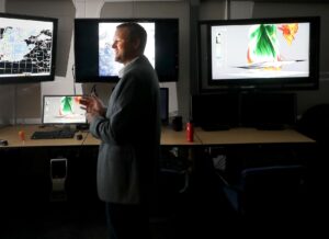
Shane Hubbard, a CIMSS researcher at the UW-Madison, is framed by computer monitors showing weather models at the university’s Atmospheric and Oceanic Sciences Building.  (Photo credit: John Hart, State Journal archives)

As we have opined a number of times before in this column, the development of numerical weather prediction (NWP) — the use of computers to mathematically produce weather forecasts — is one of the most unheralded scientific advances of the 20th century.

Coupled with the ubiquitous mobile phones we all use, this revolution has enabled us, at a glance, to get a sense of the coming weather days in advance.

It turns out that the first meeting ever convened to discuss the possibility of developing NWP took place just over 75 years ago, on Jan. 9, 1946, at the then-Weather Bureau’s headquarters less than a mile from the White House.

Present at this initial meeting was the chief of the Weather Bureau, Francis Reichelderfer, his top staff, a number of military meteorologists and the Princeton mathematician John von Neumann. Accompanying von Neumann to the meeting was Vladimir Zworykin, a physicist employed by RCA who had invented the scanning television camera. They had come to discuss their proposal to use the electronic digital computer von Neumann was then developing to not only forecast the weather, but also to control it.

As amazing as it sounds to us today, the original impetus for the development of NWP was to calculate where, and to what degree, nuclear explosions might be set off to alter the weather when destructive storms appeared on the forecast horizon. It was thought that this “intelligent” control of the weather would be rooted in reasonably accurate prediction of it for a couple of days in advance.

Fortunately, the evolving ethics of the nuclear age along with the extraordinary challenge presented by the originally secondary problem of providing computer-based forecasts quickly forced a humbler approach to this spectacular advance in weather prediction.

Category: History, Meteorology

Comments Off on When was the use of computers for weather prediction first considered?

How do ice crystals form and grow?

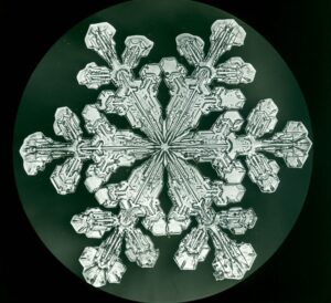
Snowflake photographed by Wilson Bentley

This question was considered by astronomer Johannes Kepler about 400 years ago.

Kepler published an article on the topic in 1611. He hypothesized that the crystals were made of subunits that combined to form the symmetrical shapes of ice crystals.

Perhaps the most well-known person to study ice crystals was Wilson A. Bentley, a Vermont farmer. He captured more than 5,000 exquisite photographs during his lifetime. His photographs document that ice crystals are all six-sided. Their beauty is echoed by the complexity of how they form and grow.

Physical chemistry explains the geometry. Ice crystals are made of water molecules, which are formed by two hydrogen atoms and one oxygen atom. The two hydrogen atoms form an angle of 104.5 degrees from the atomic nucleus. The oxygen atom attracts a larger share of electrons, making the water molecule slightly negative on one side and slightly positive on the other. When water freezes, the bipolar molecules are attracted to each other, forming a hexagonal crystal lattice.

When ice crystals form, water molecules cannot deposit onto the crystal haphazardly. The molecules must fit into the shape of the crystal.

The shape of a crystal is called its habit. As Bentley’s photographs captured, there are four basic habits of ice crystals: the hexagonal plate, the needle, the column and the dendrite.

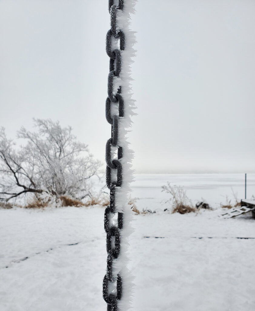
Rime ice from freezing fog

Temperature and the vapor content of the environment determine the particular crystal habit. As the crystal moves through the atmosphere, the temperature and humidity change, which can change the growth habit, producing very complex shapes. The final shape of the crystal will vary according to environmental factors it experienced as it traversed the atmosphere.

Steve Ackerman and Jonathan Martin, professors in the UW-Madison Department of Atmospheric and Oceanic Sciences, are guests on WHA radio (970 AM) at 11:45 a.m. the last Monday of each month.

Category: Meteorology, Phenomena

Comments Off on How do ice crystals form and grow?

What were the memorable U.S. weather events of 2020?

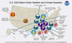
This NOAA map denotes 16 separate billion-dollar weather and climate disasters that impacted the United States from January-September 2020.

The year 2020 will be noted for some memorable and record-breaking weather.

This year saw the most active and seventh-costliest Atlantic hurricane season on record. There were 13 hurricanes, six major hurricanes and 12 storm systems that made landfall in the U.S., causing 409 deaths and more than $40 billion in damages. Hurricane Laura was the strongest land-falling U.S. hurricane of the season; it hit the Louisiana coast with 150 mph winds and higher than 15 feet of storm surge.

A strong derecho moved through Nebraska, Iowa, Illinois, Wisconsin and Indiana on Aug. 10-11. The storm front moved at an average speed of 55 mph with winds peaking at 110–140 mph. It caused severe damage to corn and soybean crops.

There were 1,022 confirmed tornadoes in the U.S. this year, killing 78 people. This included a widespread and deadly tornado outbreak over the southeastern U.S. on Easter Sunday and the following Monday. There were 20 weak tornadoes in Wisconsin, which climatically has an average of 23 a year.

Between Sept. 28 and Oct. 4, there were 232 waterspouts over the Great Lakes. There was also another waterspout outbreak on the Great Lakes between Aug. 16-18, when the count was 88 spouts. These large outbreaks resulted from a cold Canadian air mass moving over the Great Lakes.

The winter storm that hit the Northeast Dec. 16-17 covered much of Pennsylvania, New York and New England with heavy snow cover. Some cities observed 3 to 4 inches of snow per hour.

The western U.S. experienced a series of major wildfires in 2020. The fires burned more than 8.2 million acres and covered large regions of the U.S. with veils of smoke.

Steve Ackerman and Jonathan Martin, professors in the UW-Madison Department of Atmospheric and Oceanic Sciences, are guests on WHA radio (970 AM) at 11:45 a.m. the last Monday of each month.

Category: Meteorology, Severe Weather

Comments Off on What were the memorable U.S. weather events of 2020?

What and when is the winter solstice?

The winter solstice — in Latin, sol or “sun” and stice, “come to a stop” — is the day of the year with the fewest hours of daylight in the Northern Hemisphere. This year it occurs at 4:02 a.m. Monday.

As Earth orbits the sun, its axis of rotation is tilted at an angle of 23.5 degrees from its orbital plane. Because Earth’s axis of spin always points in the same direction — toward the North Star — the orientation of Earth’s axis to the sun is always changing as Earth orbits around the sun.

As this orientation changes throughout the year, so does the distribution of sunlight on Earth’s surface at any given latitude. This links the amount of solar energy reaching a location to the time of year and causes some months of the year to always be warmer than others — in other words, the seasons.

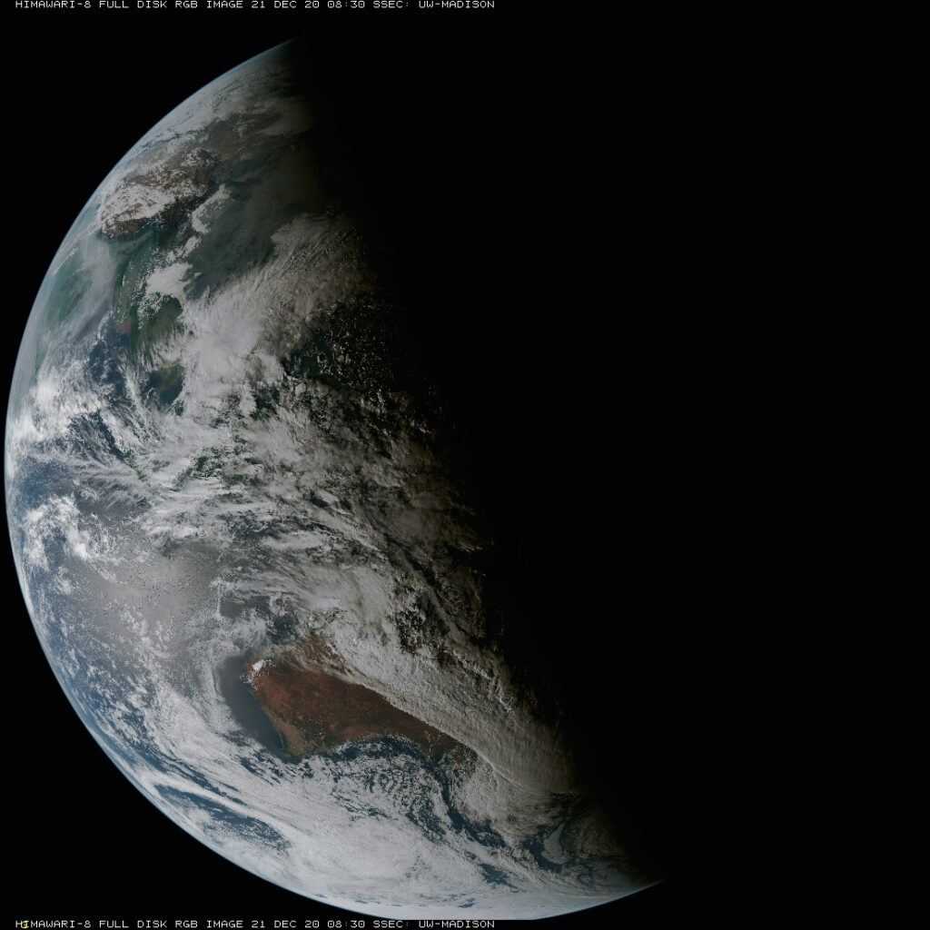
On the Northern Hemisphere’s winter solstice, the northern spin axis is pointed away from the sun, and latitudes north of the Arctic Circle — 66.5 degrees North — have 24 hours of darkness.

Solstice from space.

On this day we have our shortest day and longest night of the year in terms of daylight. But our earliest sunset happens before the December solstice, and our latest sunset occurs after the winter solstice. Why?

The time when the sun reaches its highest point in the sky is called solar noon. The number of daylight hours before solar noon is the same as the amount of light after solar noon.

Solar noon rarely occurs exactly at clock noon. In early December, solar noon comes nearly 10 minutes earlier than clock noon than it does at the winter solstice. In early December, since solar noon comes earlier relative to clock noon than at the winter solstice, by our clocks the time of sunrise comes later on the solstice.

Steve Ackerman and Jonathan Martin, professors in the UW-Madison department of atmospheric and oceanic sciences, are guests on WHA radio (970 AM) at 11:45 a.m. the last Monday of each month.

Category: Seasons

Comments Off on What and when is the winter solstice?

What created season’s first snowstorm?

Even if you are not a particular fan of winter weather, it is hard to deny that there is something about the first snow of the season.

In fact, British author J.B. Priestley expressed its transcendent nature beautifully when he wrote: “The first fall of snow is not only an event, it is a magical event. You go to bed in one kind of world and wake up in another quite different, and if this is not enchantment then where is it to be found?”

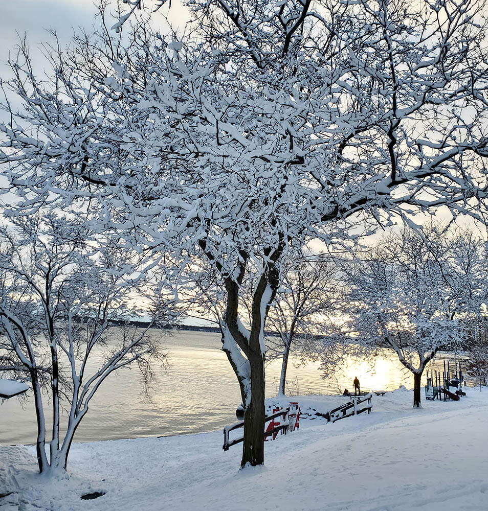
A snow covered park along Madison’s Lake Monona
on Saturday December 12th.

On Friday night and Saturday, Dane County experienced its first substantial snow with 6.4 inches recorded at the airport. This magical event is the result of very specific physical circumstances. The sun has been down at the North Pole since Sept. 21, and the Arctic night has subsequently crept slowly southward each day since helping to produce larger and larger amounts of cold wintertime air to the north.

Several days before the first flakes fell, the atmosphere was stirring many thousands of miles away throughout the full 6-mile depth of the troposphere. Almost imperceptible at first, a weak counterclockwise spinning air mass began to develop at the tropopause — the top of the troposphere. As this feature gradually matured it was empowered to create a similar vortex near the surface of the Earth — a surface low-pressure center. As that circulation intensified, it forced the production of clouds and precipitation over a wide area, with some of the precipitation falling as rain and some as snow.

The precise track of that low-pressure center determined who got rain and who got snow. At this time of the year, if the track of a surface low is to our southeast, say on a line from St. Louis to Chicago, we here in Dane County remain on the cold air side of the storm during its lifecycle.

So the next time you enjoy a quiet walk in the snow, consider that a long list of circumstances had to have played out in precise sequence in order to deliver you the magic. It is nothing less than a miracle.

Steve Ackerman and Jonathan Martin, professors in the UW-Madison Department of Atmospheric and Oceanic Sciences, are guests on WHA radio (970 AM) at 11:45 a.m. the last Monday of each month.

Category: Meteorology, Seasons

Comments Off on What created season’s first snowstorm?