How much energy goes into making snow?

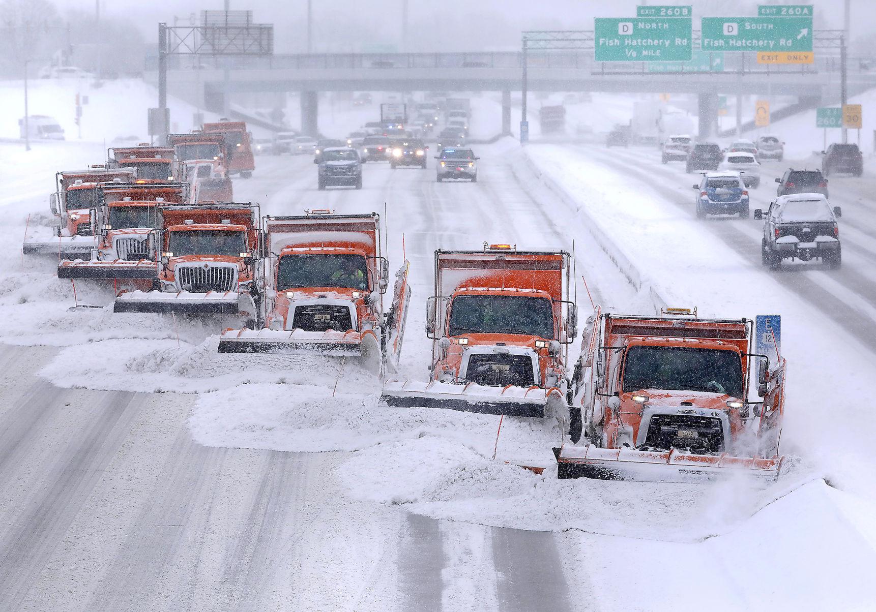
Since Dec. 1, Madison and Dane County have received approximately 40 inches of snow — 3 inches above normal for that span.

Snow is a form of solid water, and water is the only substance that occurs naturally in all three phases — solid, liquid and invisible gas — in the Earth’s atmosphere.

Snowflake (Photo credit: Wilson Bentley Snowflake Collection)

Of course, that means that the 40 inches of snow began as the equivalent amount of water in the invisible vapor, or gas, phase before being transformed into solid water.

Everyone knows that melting ice into liquid water requires energy. Not surprisingly, energy is also required to transform liquid water into water vapor, the familiar process of evaporation.

The particular amounts of energy needed to accomplish these changes of phase are known as latent heats — the latent heat of melting for the first one and the latent heat of evaporation for the second.

When a cloud of invisible water vapor condenses into a puddle of liquid water, the latent heat of condensation (equal to the latent heat of evaporation) is released to the environment. Also, when that puddle freezes into ice, the latent heat of fusion (equal to the latent heat of melting) is similarly released, incoherently, to the environment.

Since we know the depth of liquid equivalent precipitation involved in delivering us 40 inches of snow since Dec. 1, the area of Dane County, and the latent heats of condensation and fusion, we can calculate how much energy has been released to the atmosphere in the production of that much snow. Without providing the details of the calculation, we can report that the amount of energy involved could power the entire Madison metro area for approximately 8.8 years. Clearly, there are huge amounts of energy involved.

Steve Ackerman and Jonathan Martin, professors in the UW-Madison department of atmospheric and oceanic sciences, are guests on WHA radio (970 AM) at 11:45 a.m. the last Monday of each month. Send them your questions at stevea@ssec.wisc.edu or jemarti1@wisc.edu.

Category: Meteorology, Seasons

Comments Off on How much energy goes into making snow?

When does the winter cold end?

It has now been more than two weeks since our last below-zero morning here in Madison — Feb. 3 was minus 8 degrees. Thus, a natural question might be this: Are we done with bitter cold for the winter?

If we use an overnight low temperature at or below zero as the metric, then 45 of the 83 winters since 1939-40 have seen a cold spell after Feb. 20 — a surprising 54.2% of the time. In fact, in 1982, the last zero degree (or colder) night was not until April 7, the latest date in the last 83 years.

On the other hand, 12 of the past 83 years have seen the last below-zero morning of the year before Feb. 3, with the earliest ever such date being Jan. 8 in 2017.

None of this really has any predictive value for the rest of this year. In fact, it should be noted that in the past 20 years, the latest below-zero morning occurred on March 10, in 2003.

Recent research at UW-Madison has documented a systematic warming of the lower troposphere during Northern Hemisphere winter over the past 74 seasons. Elements of that analysis have suggested that the hemisphere begins its warmup much earlier than the spring equinox, which occurs around March 22. In fact, the hemispheric warmup really accelerates in the first few days of March.

NOAA’s Temperature Outlook for March 2023

Though it is true that this hemispheric signal does not always translate to a similar warmup at any given location, it is comforting to know that the entire hemisphere is trying to shake off winter as early as the next couple of weeks. So, climatologically, we really do not have that much further to go.

Steve Ackerman and Jonathan Martin, professors in the UW-Madison department of atmospheric and oceanic sciences, are guests on WHA radio (970 AM) at 11:45 a.m. the last Monday of each month. Send them your questions at stevea@ssec.wisc.edu or jemarti1@wisc.edu.

Category: History, Seasons

Comments Off on When does the winter cold end?

What is a stratospheric sudden warming?

The region of the atmosphere closest to Earth, where the temperature decreases as you go up, is called the troposphere. The top ranges from about 6 miles over the cold poles to 10 miles over the tropics.

Earth’s Atmosphere

Above the tropopause lies the stratosphere, where temperature increases with altitude. Temperatures increase because ozone molecules in the stratospheric ozone layer absorb solar energy within the stratosphere. Air flow in the stratosphere is much less turbulent than in the troposphere. For this reason, jet aircraft pilots like to cruise at stratospheric altitudes, where the flight is less bumpy. In polar regions, the bottom edge of the stratosphere starts about five miles above the ground and extends upwards to around 30 miles.

The polar vortex is a band of strong winds, high up in the atmosphere, that spins counterclockwise around the North Pole. At the southern edge of the vortex is the polar jet stream, which separates warm air to its south from increasingly colder air to its north.


A sudden stratospheric warming, or SSW, occurs in the winter, when the polar stratosphere warms and the winds that normally flow from west to east around the pole weaken dramatically and even reverse direction. This phenomenon occurs about six times per decade and leads to a breakdown of the polar vortex. SSWs can cause the polar night jet to weaken, which allows cold air near the polar cap to expand into the middle latitudes.

SSW leads to cold air descending and warming rapidly, depicted by magenta line on the graph showing the sudden jump in temperature. This can lead to a displacement of the polar vortex, with cold air descending into the mid-latitudes. Credit: NOAA’s CPC

Weather models are signaling a sudden stratospheric warming event in the coming week. This could bring more wintry weather across the Northern Hemisphere. The main uncertainty with these events is that we don’t know exactly where this cold air will end up across the Northern Hemisphere.

Steve Ackerman and Jonathan Martin, professors in the UW-Madison department of atmospheric and oceanic sciences, are guests on WHA radio (970 AM) at 11:45 a.m. the last Monday of each month. Send them your questions at stevea@ssec.wisc.edu or jemarti1@wisc.edu.

Category: Meteorology, Phenomena

Comments Off on What is a stratospheric sudden warming?

How did January measure up?

What a strange month January 2023 was in Madison.

The cloudiness was remarkably persistent and, though we don’t have a measurement of that variable for the month at hand, anecdotal assertions we have heard suggest that Madison got only about 8% of its possible January sunshine this past month.

Thanks to a major snow event the last weekend of the month, in which 7.3 inches of snow fell on Saturday and Sunday combined, we ended up at just about a normal amount for the month (13.9 inches was 0.2 inches above the average).

January 2023 climate statistics for Madison and Milwaukee complied by the NWS

Of all the strange aspects to the last month, however, the strangest might just be the temperature. For almost the first four weeks of the month (that is, through Jan. 27) we averaged 10.53 degrees above normal — way out of line.

In fact, had we managed to remain at that pace we would have ended up with the third-warmest January ever recorded in Madison, behind January 2006 (plus 11 degrees) and 1933 (plus 10.7 degrees).

As it was, the snowstorm on Jan. 28 ushered in a fairly significant cold spell during which we recorded our coldest morning of the season at minus 11 on Jan. 31. We ended up at 7.3 degrees above normal for the month, which was still the eighth-warmest January ever in Madison. Milwaukee, at 7.9 degrees above its normal, recorded its fourth-warmest January ever.

Of course, none of this has much to say about what February might be like, but it is true that, climatologically at least, we have already been through our coldest week of the winter.

Steve Ackerman and Jonathan Martin, professors in the UW-Madison department of atmospheric and oceanic sciences, are guests on WHA radio (970 AM) at 11:45 a.m. the last Monday of each month. Send them your questions at stevea@ssec.wisc.edu or jemarti1@wisc.edu.

Category: Meteorology, Seasons

Comments Off on How did January measure up?

What is intermittent snow?

Dane County snowplows clear the Beltline during a 2019 snowfall. (Photo credit: John Hart, State Journal archives)

A weather forecast of snow indicates a steady fall of snow. The forecast may be modified by terms such as “light,” “moderate” or “heavy” to indicate the intensity of the snowfall.

The intensity is measured in terms of visibility during the snowfall:

  • Light snow — visibility of 1 kilometer (1,100 yards) or greater.
  • Moderate snow — visibility between 0.5 kilometer (550 yards) and 1 kilometer (1,100 yards).
  • Heavy snow — visibility of less than 0.5 kilometer (550 yards).

A forecast for intermittent snowfall often refers to light snow falling for short durations. No accumulation, or a light dusting, is expected. The National Weather Service defines snow flurries as intermittent light snow. Snow flurries are short durations of snowfall and produce no measurable precipitation, only trace amounts. Snow flurries tend to come from stratiform clouds.

The term “snow shower” refers to a short period of light to moderate snowfall and is characterized by a sudden beginning and ending of the snowfall. Some accumulation is possible. The atmosphere is susceptible to the development of snow showers when the difference between the surface temperature and the temperature some distance above the ground is large.

Snow squalls are brief, intense snow showers accompanied by strong, gusty winds. Accumulation of snow on the ground may be significant during snow squalls.

Blizzard conditions include winds greater than 35 mph with heavy snow or blowing snow. Visibility is poor, less than a quarter of a mile, and these conditions are expected for a period of three hours or more.

Snow is difficult to measure because it can be moved by the wind. Newly fallen snow is reported in inches to the nearest tenth of an inch. The measurement is taken as soon as the snowfall has stopped. Meteorologists use a snowboard — a flat wooden surface -– and measure in a location where drifting does not usually occur.

Steve Ackerman and Jonathan Martin, professors in the UW-Madison department of atmospheric and oceanic sciences, are guests on WHA radio (970 AM) at 11:45 a.m. the last Monday of each month. Send them your questions at stevea@ssec.wisc.edu or jemarti1@wisc.edu.

Category: Meteorology, Seasons

Comments Off on What is intermittent snow?