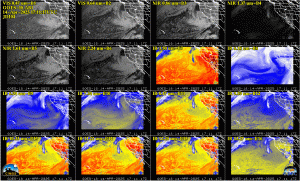
Satellite data help forecast the weather in two ways: expert forecasters interpret the satellite images and numerical weather-prediction models assimilate the data they collect. Image analysis plays an important role in short-term forecasts, those that predict the weather 1 to 3 hours into the future, while numerical weather predictions are more useful in 12-hour to 3-day forecasts.

While weather forecasters routinely analyze current satellite observations, most data never reach forecasters’ eyes. Most satellite observations are assimilated into numerical weather-prediction models. Today’s weather forecast models rely on satellite data to make accurate weather predictions. These satellite observations include the vertical distribution of temperature and humidity, cloud distributions, land and sea surface temperatures, location of volcanic ash, fires, and wind speeds and directions.
Professor Verne Suomi (1916-1995) is internationally regarded as the Father of Satellite Meteorology. In the early 1960’s he advocated for the benefits that would be gained by observing a single weather phenomenon from space at frequent time intervals. Suomi and Robert Parent, a professor in electrical engineering, started the Space Science and Engineering Center (SSEC), where they invented the Spin Scan Radiometer. Suomi and Parent saw their spin-scan camera launched in 1966 on NASA’s new geostationary Advanced Technology Satellite (ATS-1). These concepts enabled the tracking of movement and development of weather systems, and thus revolutionized satellite meteorology. For many years the spin-scan radiometer was the instrument on the NOAA’s geostationary weather satellites that generated the time sequences of cloud images seen on television weather shows and now the internet. The Space Science and Engineering Center at the University of Wisconsin-Madison, is regarded as the Birthplace of weather satellites.
We have much to learn about the vagaries of weather. One of the most important means of doing so involves the fleet of spacecraft dedicated to the task of watching our atmosphere. Future satellite systems will continue to improve our ability to monitor and forecast storms, and Wisconsin will continue to play a key role in the development of weather satellites and their use in weather forecasting.
Steve Ackerman and Jonathan Martin, professors in the UW-Madison department of atmospheric and oceanic sciences, are guests on WHA radio (970 AM) at noon the last Monday of each month. Send them your questions at stevea@ssec.wisc.edu or jemarti1@wisc.edu.

