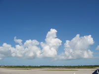
Most clouds, especially those with flat bottoms, form in rising air. The air can be forced to rise due to convection, frontal lifting, or when air near the surface flows together from different directions. As a volume, or parcel, of air rises, it expands and cools. In addition, the relative humidity of the rising air increases. As the parcel approaches the point of saturation, water vapor condenses to form tiny water droplets or ice particles, creating a cloud. Saturation occurs at a distinct altitude, which varies depending on the temperature and humidity structure of the atmosphere. Below this condensation level clouds do not form.

Often low clouds, like stratus and cumulus, appear to have flat bases. These clouds form as air near the ground is rising. As the air rises, it expands as pressure decreases with altitude. This expansion results in a cooling, which causes the relative humidity in the rising parcel to increase. The temperature of the rising air approaches the dew point temperature. When it reaches the height where those two temperatures are equal, the relative humidity is 100% and a cloud forms. Meteorologists call this altitude the lifting condensation level.
The temperature and dew point temperature near the ground are quite uniform and on the size scale of a cloud or a collection of clouds. So, as a layer of air near the ground rises, the height at which condensation occurs does not vary much and the cloud base height appears uniform. From the ground, these bottoms appear very flat but if you are in a plane and fly through these bases during take-off or landing, you’ll be close enough to notice that the cloud bases are not a sharp boundary.
Steve Ackerman and Jonathan Martin, professors in the UW-Madison department of atmospheric and oceanic sciences, are guests on WHA radio (970 AM) at noon the last Monday of each month. Send them your questions at stevea@ssec.wisc.edu or jemarti1@wisc.edu.

