It has been a fairly wintry week across the Great Lakes states, including here in southern Wisconsin.

Through Saturday night, it had snowed on five straight days in Madison, a total of 4.4 inches. The same pool of cold air above the ground that led to Madison’s intermittent snow showers stretched all the way across the Great Lakes. In fact, the Saturday morning temperature at 1.5km above the surface at Buffalo, New York, was minus 14 Celsius (about 7 degrees Fahrenheit).
Meanwhile, as the cold season begins, the lakes are as warm as they will be all winter, with water temperatures in eastern Lake Erie last week at or slightly above 14 Celsius (about 57 degrees Fahrenheit). Therefore, the lapse rate — the rate at which temperature decreases with increasing height — above the lake was abut 18.7C/km, well above the 10C/km threshold necessary for absolute instability.
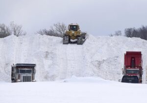
The consequence was that huge amounts of heat and water (in the vapor phase) were extracted from the lake surface and turned into lake effect snow — 77 inches in the Buffalo suburb of Orchard Park.
Though minus 14C at 1.5 km is pretty cold, that is not the coldest it has ever been at that height across the lakes in mid-November. It is likely that this weekend’s event was record-setting primarily because the air was flowing along the long axis of a warmer-than-normal Lake Erie, allowing the cold dry air the maximum amount of time to evaporate water vapor off the lake to produce the snow.
That all-important wind direction was determined by the particular distribution of high- and low-pressure systems across all of eastern North America at the initiation of the lake effect event. Though not random, this distribution is highly variable and must align precisely with the other conditions to transform a run-of-the-mill lake effect snow event into a historic one.

